
The Virgin Mary
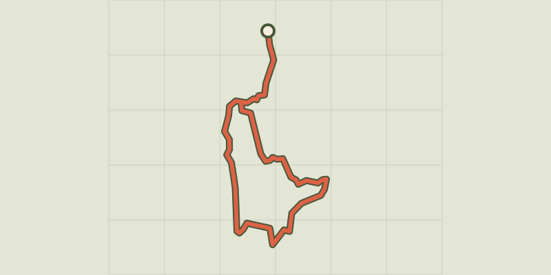
Key facts
- Distance
- 1.9 km
- Ascent
- +15 m
- Descent
- −6 m
- Estimated time
- 25 min
- hiking
- Difficulty
- Easy
- official rating
- Route
- Loop
- back to the start
Profile and gradient
- under 10%
- 10 to 20%
- over 20%
Gradient along the route: 1.9 km under 10%. Elevation from 214 m to 222 m over 1.9 km.
Description
This walk is particulary well adapted to little explorers, who can enter without fear the maze of rocks with its secret passages and small caves. The Bois de Païolive is an enchanting wood and one of the strangest curiosities in the Ardèche department. This forest of ancient oaks with exceptional heritage value (because of their natural state and great biodiversity) is a natural labyrinth. Signposts will guide you all along this route. In the description below, the signposted place names and/or directions are given in bold italics between quotation marks : From Les Clairières car park, make sure you follow the green waymarks. - At Les Clairières car park, follow “Circuit de la Vierge 0,1 km”.
Difficulty
Official rating: easy, by Parc national des Cévennes.
Before you go
- This walk, while in the “easy” category, is rocky and steep in parts and slippery when wet. You must have appropriate footwear.
- Make sure your equipment is appropriate for the day’s weather conditions. Remember that the weather changes quickly in the mountains. Take enough water, wear sturdy shoes and put on a hat. Please close any gates and barriers behind you.
- You must stay on the waymarked paths to preserve this fragile environment, which is a protected site of the European network Natura 2000 and a sensitive natural space.
Getting there
Start: Berrias-et-Casteljau, Berrias-et-Casteljau (07).
Sources
- Track: Parc national des Cévennes, Licence Ouverte 1.0, Licence Ouverte 1.0 (Etalab) (destination.cevennes-parcnational.fr/trek/96981-Circuit-de-la-Vierge). Time estimated by GPX Path with the Mac app rule, breaks not included.
- Official elevation gain: 15 m, Parc national des Cévennes
Nearby tracks

 © OpenStreetMap, SRTM · OpenTopoMap (CC-BY-SA)
Saint-Eugène hermitage
Auvergne-Rhône-Alpes, Berrias-et-Casteljau (07) · LoopOfficial rating by Parc national des Cévennes © OpenStreetMap, SRTM · OpenTopoMap (CC-BY-SA)
The cliff walk
Cévennes, Berrias-et-Casteljau (07) · LoopOfficial rating by Parc national des Cévennes © OpenStreetMap, SRTM · OpenTopoMap (CC-BY-SA)
The fox’s cave
Cévennes, Berrias-et-Casteljau (07) · LoopOfficial rating by Parc national des Cévennes © OpenStreetMap, SRTM · OpenTopoMap (CC-BY-SA)
Banne
Cévennes, Banne (07) · LoopOfficial rating by Parc national des Cévennes © OpenStreetMap, SRTM · OpenTopoMap (CC-BY-SA)
The wash houses (north)
Cévennes, Saint-Paul-le-Jeune (07) · LoopOfficial rating by Parc national des Cévennes © OpenStreetMap, SRTM · OpenTopoMap (CC-BY-SA)
The wash houses (south)
Cévennes, Saint-Paul-le-Jeune (07) · LoopOfficial rating by Parc national des Cévennes