
Le Single (by mountain-bike)
Key facts
- Distance
- 23.0 km
- Ascent
- +1,049 m
- Descent
- −782 m
- Estimated time
- 3 hr 15
- mtb
- Difficulty
- Difficult
- official rating
- Route
- Loop
- back to the start
Profile and gradient
- under 10%
- 10 to 20%
- over 20%
Gradient along the route: 19.0 km under 10% and 4.0 km at 10 to 20%. Elevation from 501 m to 1,031 m over 23.0 km.
Description
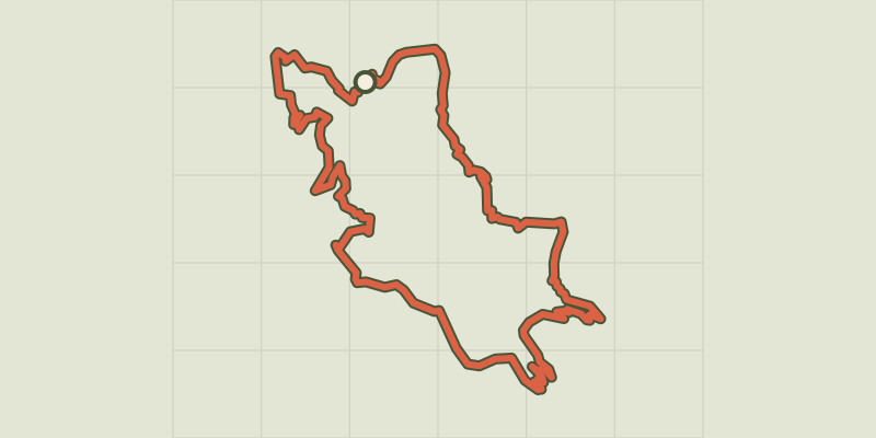
Le Single trail goes around the summit of the same name, part limestone part schist, and offers numerous viewpoints over the upper Tarn valley and Mont Lozère. Mountain-bike route #5. Quite smooth despite a descent on a single-lane and stony path. From Ispagnac, cycle to Quézac via the town gardens. Then climb to Javillet and continue on the forestry track to reach Le Tomple. Take the lane on the left (do not go through the hamlet) that joins up with the D 16 road. Go downhill on a stony single-track path to reach a track that leads to Monteils. Go downhill towards Salièges; turn left before you arrive at Salièges and take the path towards Fayet. Bike along the Tarn on this track to Fayet, Bieissette and then Ispagnac.
Difficulty
Official rating: difficult, by Parc national des Cévennes.
Before you go
- No cycling off-track. You are strongly advised to wear a helmet. Do not forget your repair kit and a small set of tools. Shut all gates and barriers after yourself. Slow down in farms and hamlets.
Getting there
Start: Ispagnac, Ispagnac (48).
Sources
- Track: Parc national des Cévennes, Licence Ouverte 1.0, Licence Ouverte 1.0 (Etalab) (destination.cevennes-parcnational.fr/trek/38795-Le-single---VTT-n5). Time estimated by GPX Path with the Mac app rule, breaks not included.
- Official elevation gain: 1,049 m, Parc national des Cévennes
Nearby tracks

 © OpenStreetMap, SRTM · OpenTopoMap (CC-BY-SA)
The gardens of Ispagnac (by mountain-bike)
Cévennes, Ispagnac (48) · LoopOfficial rating by Parc national des Cévennes © OpenStreetMap, SRTM · OpenTopoMap (CC-BY-SA)
The Quézac River Bend (by mountain-bike)
Cévennes, Ispagnac (48) · LoopOfficial rating by Parc national des Cévennes © OpenStreetMap, SRTM · OpenTopoMap (CC-BY-SA)
The Bramont Valley (by mountain-bike)
Cévennes, Ispagnac (48) · LoopOfficial rating by Parc national des Cévennes © OpenStreetMap, SRTM · OpenTopoMap (CC-BY-SA)
The Causse Loop (by mountain-bike)
Cévennes, Florac Trois Rivières (48) · LoopOfficial rating by Parc national des Cévennes © OpenStreetMap, SRTM · OpenTopoMap (CC-BY-SA)
The Tour du Lempezou (by mountain-bike)
Cévennes, Bédouès-Cocurès (48) · LoopOfficial rating by Parc national des Cévennes © OpenStreetMap, SRTM · OpenTopoMap (CC-BY-SA)
The Tour des Puechs (by mountain-bike)
Cévennes, Bédouès-Cocurès (48) · LoopOfficial rating by Parc national des Cévennes