
The gardens of Ispagnac (by mountain-bike)
Key facts
- Distance
- 6.4 km
- Ascent
- +127 m
- Descent
- −106 m
- Estimated time
- 40 min
- mtb
- Difficulty
- Very easy
- official rating
- Route
- Loop
- back to the start
Profile and gradient
- under 10%
- 10 to 20%
- over 20%
Gradient along the route: 6.1 km under 10% and 0.3 km at 10 to 20%. Elevation from 501 m to 592 m over 6.4 km.
Description
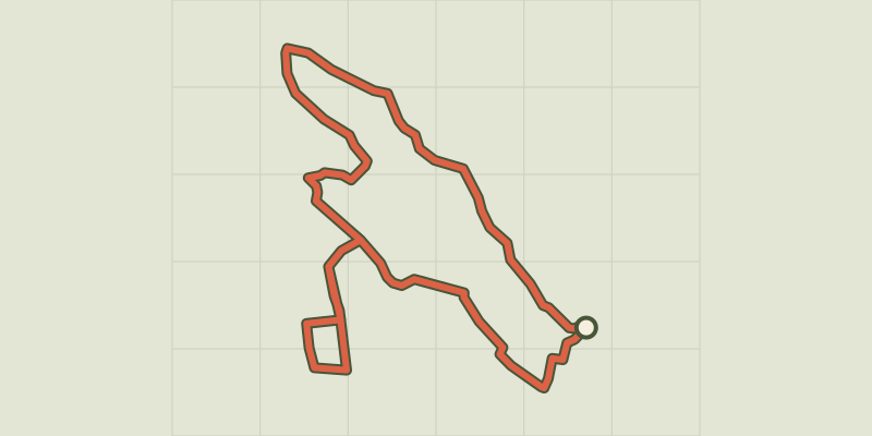
This family circuit runs alongside the river Tarn and amidst gardens and vineyards to help you explore the villages of Ispagnac and Quézac. Mountain-bike route #3. This route uses small tarred lanes and good tracks, and includes one slightly more technical downhill section. From the car park opposite the pharmacy, cycle down to the Tarn via the town gardens. Go along the river to Quézac Bridge. Cross it and go through Quézac. Turn right to get to the village gardens. Go back up to the town hall (mairie) and over the bridge. Immediately after the bridge, turn left to join up with the D 907 bis, onto which you turn right for a few metres before turning left above Ipagnac. Go through the vineyards and return to the village through the recently built part of town.
Difficulty
Official rating: very easy, by Parc national des Cévennes.
Getting there
Start: Ispagnac, Ispagnac (48).
Sources
- Track: Parc national des Cévennes, Licence Ouverte 1.0, Licence Ouverte 1.0 (Etalab) (destination.cevennes-parcnational.fr/trek/38858-Les-jardins-d-Ispagnac---VTT-n3). Time estimated by GPX Path with the Mac app rule, breaks not included.
- Official elevation gain: 127 m, Parc national des Cévennes
Nearby tracks
 © OpenStreetMap, SRTM · OpenTopoMap (CC-BY-SA)
Le Single (by mountain-bike)
Cévennes, Ispagnac (48) · LoopOfficial rating by Parc national des Cévennes © OpenStreetMap, SRTM · OpenTopoMap (CC-BY-SA)
The Quézac River Bend (by mountain-bike)
Cévennes, Ispagnac (48) · LoopOfficial rating by Parc national des Cévennes © OpenStreetMap, SRTM · OpenTopoMap (CC-BY-SA)
The Bramont Valley (by mountain-bike)
Cévennes, Ispagnac (48) · LoopOfficial rating by Parc national des Cévennes © OpenStreetMap, SRTM · OpenTopoMap (CC-BY-SA)
The Causse Loop (by mountain-bike)
Cévennes, Florac Trois Rivières (48) · LoopOfficial rating by Parc national des Cévennes © OpenStreetMap, SRTM · OpenTopoMap (CC-BY-SA)
The Tour du Lempezou (by mountain-bike)
Cévennes, Bédouès-Cocurès (48) · LoopOfficial rating by Parc national des Cévennes © OpenStreetMap, SRTM · OpenTopoMap (CC-BY-SA)
The Tour des Puechs (by mountain-bike)
Cévennes, Bédouès-Cocurès (48) · LoopOfficial rating by Parc national des Cévennes