
Three Bishops’ Cross trail
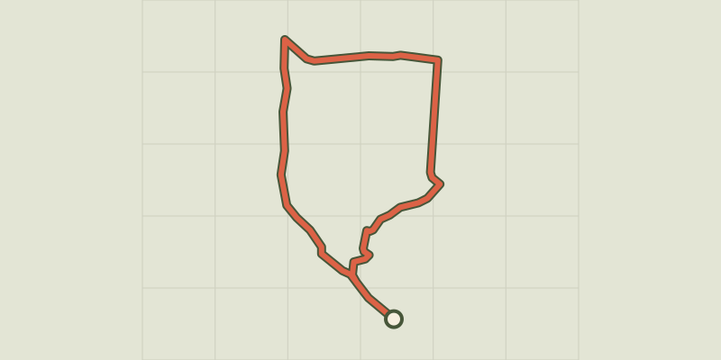
Key facts
- Distance
- 5.4 km
- Ascent
- +35 m
- Descent
- −21 m
- Estimated time
- 1 hr 15
- hiking
- Difficulty
- Very easy
- official rating
- Route
- Loop
- back to the start
Profile and gradient
- under 10%
- 10 to 20%
- over 20%
Gradient along the route: 5.4 km under 10%. Elevation from 928 m to 950 m over 5.4 km.
Description
In about 1790, when France’s départements were created, the three bishops of the Gard, Lozère and Aveyron decided to celebrate the new administrative division by having this cross put up... Enjoy the beautiful Causse atmosphere, with its vast prairie-like spaces, where sheep reign! Signposts will guide you all along this route, as well as yellow painted waymarks. In the description below, the signposted place names and/or directions are given in bold italics between quotation marks: From the departure-point, take the road leading to Les "Mazes hamlet". - In the hamlet, head towards "Croix des Trois Evêques » via "Le Sabel". - At “Croix des Trois Evêques”, turn right onto the small road for 800m. - Take on your right the path to return to "Les Mazes". Walk along the right-hand side of the farm buildings. - Just after the farm buildings, at the road, turn right and go through the hamlet to return to your point of departure.
Difficulty
Official rating: very easy, by Parc national des Cévennes.
Before you go
- Before committing yourself to a circuit, ensure that it is suitable for your activity level and ability. Remember that the weather changes quickly in the mountains. Take enough water. Please close all gates and barriers behind you.
Getting there
Start: Les Mazes - Lanuéjols, Lanuéjols (30).
Sources
- Track: Parc national des Cévennes, Licence Ouverte 1.0, Licence Ouverte 1.0 (Etalab) (destination.cevennes-parcnational.fr/trek/73153-Les-croix-des-trois-eveques). Time estimated by GPX Path with the Mac app rule, breaks not included.
- Official elevation gain: 35 m, Parc national des Cévennes
Nearby tracks

 © OpenStreetMap, SRTM · OpenTopoMap (CC-BY-SA)
Pradines
Cévennes, Lanuéjols (30) · LoopOfficial rating by Parc national des Cévennes © OpenStreetMap, SRTM · OpenTopoMap (CC-BY-SA)
The fox trail
Cévennes, Lanuéjols (30) · LoopOfficial rating by Parc national des Cévennes © OpenStreetMap, SRTM · OpenTopoMap (CC-BY-SA)
Sur les pas des gens d'ici (4 jours)
Cévennes, Lanuéjols (30) · Point to pointOfficial rating by Parc national des Cévennes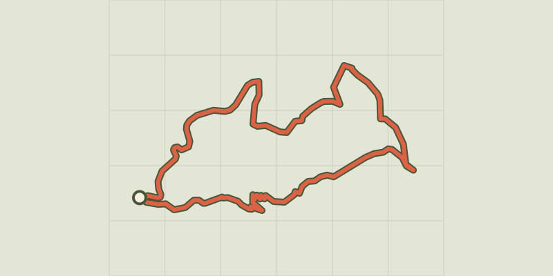 © OpenStreetMap, SRTM · OpenTopoMap (CC-BY-SA)
Le Devois cross
Cévennes, Lanuéjols (30) · LoopOfficial rating by Parc national des Cévennes © OpenStreetMap, SRTM · OpenTopoMap (CC-BY-SA)
Pauparelle
Cévennes, Meyrueis (48) · LoopOfficial rating by Parc national des Cévennes © OpenStreetMap, SRTM · OpenTopoMap (CC-BY-SA)
O Roquedols, my Roquedols!
Cévennes, Meyrueis (48) · LoopOfficial rating by Parc national des Cévennes