
La Tête de Vautisse

Key facts
- Distance
- 11.2 km
- Ascent
- +755 m
- Descent
- −727 m
- Estimated time
- 4 hr 20
- hiking
- Difficulty
- Moderate
- official rating
- Route
- Out and back
- same way back
Profile and gradient
- under 10%
- 10 to 20%
- over 20%
Gradient along the route: 5.0 km under 10%, 4.5 km at 10 to 20% and 1.7 km over 20%. Elevation from 2,386 m to 3,095 m over 11.2 km.
Description
A hike to discover the nival stage (above 3000 metres) with relatively easy access conditions. "At the foot of the Tête de Vautisse, the stunted vegetation gives way to an almost solely mineral environment. The rock ptarmigan, emblematic species of the high summits lives in such seemingly inhospitable conditions. Groups of several heads are seen on a regular basis.” Damien Combrisson, warden in the Embrunais area From the car park, take the footpath on the left of the flat terrain, which leads here and there along the Alp stream with a regular and moderate incline. About 40 minutes further on, the path forks to the left and continues along the Prénetz ridge through black soil. Off a bend, the footpath leads to a terrace (the Selle valley) revealing three small mountain lakes that dry out some years. - With the lakes to the right, the footpath continues a slight descent, the lowest point of which is the Rougnoux pass. The climb towards the summit starts properly from this pass. Numerous bends mean a relatively steep walk where the incline is generally between 30 and 35°. Shortly before the summit, a terrace will enable you to catch your breath. - The return trip will be by the same path. A small circuit is also possible from the summit. Leaving the path by which you came on the right, take the stretch of path to the left as far as the Rougnoux pass.
Difficulty
Official rating: moderate, by Parc national des Écrins.
Before you go
- The major part of the footpath covers alpine lawns that are grazed by a flock of around 1500 sheep during the mountain pasture period. It is important to respect the shepherd's work, not to scare the animals (in particular the dogs) or separate the flock (by walking though it).
Getting there
Start: Cabane de l'Alp, Réotier, Réotier (05).
Sources
- Track: Parc national des Écrins, Licence Ouverte 2.0, Licence Ouverte 2.0 (Etalab) (destination.ecrins-parcnational.fr/trek/921647-Tete-de-Vautisse). Time estimated by GPX Path with the Mac app rule, breaks not included.
- Official elevation gain: 755 m, Parc national des Écrins
Nearby tracks

 © OpenStreetMap, SRTM · OpenTopoMap (CC-BY-SA)
Tête de Vautisse - Réotier
Écrins, Réotier (05) · Out and backOfficial rating by Parcs naturels régionaux de Provence-Alpes-Côte d'Azur © OpenStreetMap, SRTM · OpenTopoMap (CC-BY-SA)
The Couleau valley
Écrins, Saint-Clément-sur-Durance (05) · LoopOfficial rating by Parc national des Écrins © OpenStreetMap, SRTM · OpenTopoMap (CC-BY-SA)
RANDOLAND : Champcella
Écrins, Champcella (05) · LoopOfficial rating by Parc national des Écrins © OpenStreetMap, SRTM · OpenTopoMap (CC-BY-SA)
Le circuit de Clot Laffont
Écrins, Champcella (05) · LoopOfficial rating by Parc national des Écrins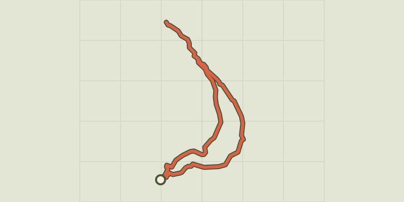 © OpenStreetMap, SRTM · OpenTopoMap (CC-BY-SA)
Saint-Alban loop
Écrins, Châteauroux-les-Alpes (05) · LoopOfficial rating by Parc national des Écrins © OpenStreetMap, SRTM · OpenTopoMap (CC-BY-SA)
THEMED PATH: The precipice path
Écrins, Champcella (05) · LoopOfficial rating by Parc national des Écrins