
THEMED PATH: The precipice path
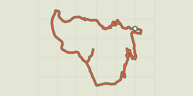
Key facts
- Distance
- 4.6 km
- Ascent
- +272 m
- Descent
- −249 m
- Estimated time
- 1 hr 35
- hiking
- Difficulty
- Easy
- official rating
- Route
- Loop
- back to the start
Profile and gradient
- under 10%
- 10 to 20%
- over 20%
Gradient along the route: 2.7 km under 10%, 1.2 km at 10 to 20% and 0.8 km over 20%. Elevation from 922 m to 1,142 m over 4.6 km.
Description
A pathway steeped in history against a backdrop full of natural riches! “Climbing above the Durance, this itinerary gives a measure of the importance of this valley which became a key communication route in the distant past. You start to imagine all those people who have passed through it on foot over centuries and centuries;” Marie-Geneviève Nicolas,park ranger at the Parc National des Écrins From the chapel, cross the bridge over the Biaysse and immediately fork right and then left after 100 metres. - Take the gently rising path which twists and turns past some fine low stone walls and comes out onto a cultivated flat area. - Follow the path to the belvedere, making a there-and-back detour. - Follow the road right for 500 metres until you reach Pallon. Go through the village and, as you are leaving it, 100 metres after the wash house, take the track on the right which runs past a house with green shutters. The path drops back down to the chapel in Rame.
Difficulty
Official rating: easy, by Parc national des Écrins.
Before you go
- Follow the safety instructions to the letter and be sure to use safety installations, in particular near the precipice edge.
- Binoculars are recommended for observing the fauna
- Check weather conditions before setting off.
- Rescue services contact details: Secours Montagne (Mountain Rescue): +33 (0)4 92 22 22 22 or 112
- Show consideration for the work of farmers, livestock keepers and owners
- Close all gates behind you
- Take your litter home
- Do not take shortcuts across pastureland
Getting there
Start: Chapelle de Rame, Champcella, Champcella (05).
Sources
- Track: Parc national des Écrins, Licence Ouverte 2.0, Licence Ouverte 2.0 (Etalab) (destination.ecrins-parcnational.fr/trek/959354-SENTIER-THEMATIQUE-%3A-Le-Sentier-du-Gouffre). Time estimated by GPX Path with the Mac app rule, breaks not included.
- Official elevation gain: 272 m, Parc national des Écrins
Nearby tracks

 © OpenStreetMap, SRTM · OpenTopoMap (CC-BY-SA)
RANDOLAND : Champcella
Écrins, Champcella (05) · LoopOfficial rating by Parc national des Écrins © OpenStreetMap, SRTM · OpenTopoMap (CC-BY-SA)
Le circuit de Clot Laffont
Écrins, Champcella (05) · LoopOfficial rating by Parc national des Écrins © OpenStreetMap, SRTM · OpenTopoMap (CC-BY-SA)
THEMED PATH: Mr Alfred's wood
Écrins, Freissinières (05) · LoopOfficial rating by Parc national des Écrins © OpenStreetMap, SRTM · OpenTopoMap (CC-BY-SA)
RANDOLAND: Freissinières
Écrins, Freissinières (05) · LoopOfficial rating by Parc national des Écrins © OpenStreetMap, SRTM · OpenTopoMap (CC-BY-SA)
RANDOLAND: L’Argentière-la-Bessée
Écrins, L'Argentière-la-Bessée (05) · LoopOfficial rating by Parc national des Écrins © OpenStreetMap, SRTM · OpenTopoMap (CC-BY-SA)
Tour of the Pays des Ecrins in 3 days
Écrins, L'Argentière-la-Bessée (05) · Point to pointOfficial rating by Parc national des Écrins