
Le Grand Parcher circuit (no. 6)

Key facts
- Distance
- 7.8 km
- Ascent
- +221 m
- Descent
- −191 m
- Estimated time
- 55 min
- mtb
- Difficulty
- Moderate
- official rating
- Route
- Loop
- back to the start
Profile and gradient
- under 10%
- 10 to 20%
- over 20%
Gradient along the route: 6.6 km under 10% and 1.2 km at 10 to 20%. Elevation from 1,081 m to 1,263 m over 7.8 km.
Description
Circling the village of Les Vigneaux and its hamlets, this loop through welcoming and tranquil surroundings offers a magnificent panoramic view over the valley. This circuit in the municipality of Les Vigneaux follows the Gyronde, on the north-facing side, bringing you to Le Grand Parcher with its traditional houses and the village of Les Vigneaux, on the south-facing side, standing on an alluvial cone. The circuit starts near the car park on the right-hand bank of the Gyronde, on a narrow track that follows the river upstream, below the road leading to a campsite, the Camping des Vaudois - After going through the campsite, take the track on the left leading towards Le Chambon. This virtually straight path passes through a number of meadows - Cross a bridge (the Pont Haut) and join the local road. After 200 metres, at the next intersection turn right towards Le Petit Parcher - At the crossroads, turn right towards Le Grand Parcher - In Le Grand Parcher, take the road rising uphill to the left. A few metres beyond the Chapelle Saint-André, take a narrow path on the right leading towards the Rocher Blanc - As you ascend, head right on a single track until you come to the Rif Cros mountain stream - Cross the mountain stream and carry on to the centre of Les Vigneaux. When you come to the local road and the Pont du Rif you have reached your starting point
Difficulty
Official rating: moderate, by Parc national des Écrins.
Before you go
- Rescue services contact details: Secours Montagne(Mountain Rescue): +33 (0)4 92 22 22 22 or 112
- Take your litter home
- Do not take shortcuts across pastureland
Getting there
Start: Pont du Rif (côté rive droite de la Gyronde), Les Vigneaux, Les Vigneaux (05).
Sources
- Track: Parc national des Écrins, Licence Ouverte 2.0, Licence Ouverte 2.0 (Etalab) (destination.ecrins-parcnational.fr/trek/966026-VTT-N06---Circuit-du-Grand-Parcher). Time estimated by GPX Path with the Mac app rule, breaks not included.
- Official elevation gain: 221 m, Parc national des Écrins
Nearby tracks

 © OpenStreetMap, SRTM · OpenTopoMap (CC-BY-SA)
Narreyroux circuit (no. 13)
Écrins, Puy-Saint-Vincent (05) · LoopOfficial rating by Parc national des Écrins © OpenStreetMap, SRTM · OpenTopoMap (CC-BY-SA)
The Puy Saint-Vincent green route ("Voie Verte")
Écrins, Puy-Saint-Vincent (05) · Out and backOfficial rating by Parc national des Écrins © OpenStreetMap, SRTM · OpenTopoMap (CC-BY-SA)
Les Eyssuches (no. 18)
Écrins, L'Argentière-la-Bessée (05) · LoopOfficial rating by Parc national des Écrins © OpenStreetMap, SRTM · OpenTopoMap (CC-BY-SA)
The Tour des Têtes (no. 16)
Écrins, L'Argentière-la-Bessée (05) · LoopOfficial rating by Parc national des Écrins © OpenStreetMap, SRTM · OpenTopoMap (CC-BY-SA)
Les Chardons Bleus nature reserve (no. 17)
Écrins, L'Argentière-la-Bessée (05) · LoopOfficial rating by Parc national des Écrins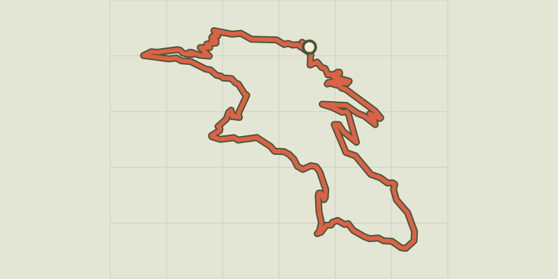 © OpenStreetMap, SRTM · OpenTopoMap (CC-BY-SA)
Col d’Anon, Col des Lauzes (no. 7)
Écrins, L'Argentière-la-Bessée (05) · LoopOfficial rating by Parc national des Écrins