
Le Saut du Laire via le Basset

Key facts
- Distance
- 11.3 km
- Ascent
- +607 m
- Descent
- −560 m
- Estimated time
- 3 hr 40
- hiking
- Difficulty
- Moderate
- official rating
- Route
- Loop
- back to the start
Profile and gradient
- under 10%
- 10 to 20%
- over 20%
Gradient along the route: 6.2 km under 10%, 4.8 km at 10 to 20% and 0.3 km over 20%. Elevation from 1,533 m to 2,069 m over 11.3 km.
Description
In this open valley of the Drac Noir, the grassy slopes, hayfields and pastures are a favourite spot for marmots. The walk across the Basset plateau gives an outstanding view of the Charnières valley. "On the Basset plateau, the griffon vultures are feasting on the raw flesh of a dead sheep. They fly away somewhat disappointed as I approach. However, the greediest one has to climb the slope in order to launch itself. Wings spread at last, it sets off on a comical, risky slalom through the rocks that are scattered across the pastures. With the extra kilos that it had gulped down it took quite some time for it to gain altitude!” Daniel Briotet, warden in the Champsaur area From the car park head up towards the hostels. At the fork in the road (sign) go right. The track runs up along the right bank of the Drac to reach the Charnières plateau. At the oratory, go left to cross the plateau. Walk up the bends that lead to the Saulce chapel. Stay on the right bank until you reach the Saut du Laire footbridge that leads to the valley of the same name. From there, take the footpath that bypasses the shepherd's hut. After a short climb, turn right, on the slope of the "balcon de Basset" itinerary. After crossing several streams, the path then heads down to Prapic. It skirts several rocky ledges, then after two large bends, reaches the bridge over the Drac. Follow the same route in the opposite direction
Difficulty
Official rating: moderate, by Parc national des Écrins.
Before you go
- This route is more enjoyable with an early start. Depending on weather conditions, be careful when crossing the steep slopes beneath the Saulce Chapel and during the descent from the Basset plateau.
Getting there
Start: Hameau de Prapic, Orcières (05).
Sources
- Track: Parc national des Écrins, Licence Ouverte 2.0, Licence Ouverte 2.0 (Etalab) (destination.ecrins-parcnational.fr/trek/920733-Le-Saut-du-Laire-par-le-Basset). Time estimated by GPX Path with the Mac app rule, breaks not included.
- Official elevation gain: 607 m, Parc national des Écrins
Nearby tracks

 © OpenStreetMap, SRTM · OpenTopoMap (CC-BY-SA)
Lac des Pisses
Écrins, Orcières (05) · Out and backOfficial rating by Parc national des Écrins © OpenStreetMap, SRTM · OpenTopoMap (CC-BY-SA)
The Saut du Laire
Écrins, Orcières (05) · Out and backOfficial rating by Parc national des Écrins © OpenStreetMap, SRTM · OpenTopoMap (CC-BY-SA)
The Poet’s tomb
Écrins, Orcières (05) · Out and backOfficial rating by Parc national des Écrins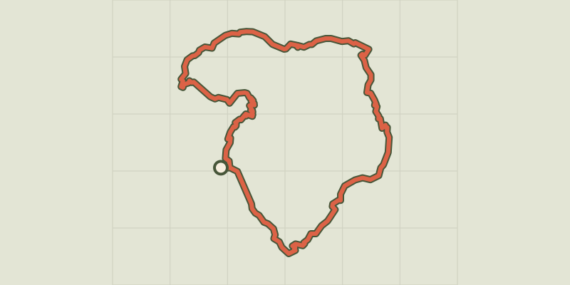 © OpenStreetMap, SRTM · OpenTopoMap (CC-BY-SA)
Tour du Grand Pinier
Écrins, Orcières (05) · Point to pointOfficial rating by Parc national des Écrins © OpenStreetMap, SRTM · OpenTopoMap (CC-BY-SA)
Col des Terres Blanches from Prapic
Écrins, Orcières (05) · Out and backOfficial rating by Parc national des Écrins © OpenStreetMap, SRTM · OpenTopoMap (CC-BY-SA)
From the Drouvet summit to Prapic
Écrins, Orcières (05) · Point to pointOfficial rating by Parc national des Écrins