
Orcières Lakes
Key facts
- Distance
- 7.1 km
- Ascent
- +96 m
- Descent
- −419 m
- Estimated time
- 2 hr
- hiking
- Difficulty
- Easy
- official rating
- Route
- Loop
- back to the start
Profile and gradient
- under 10%
- 10 to 20%
- over 20%
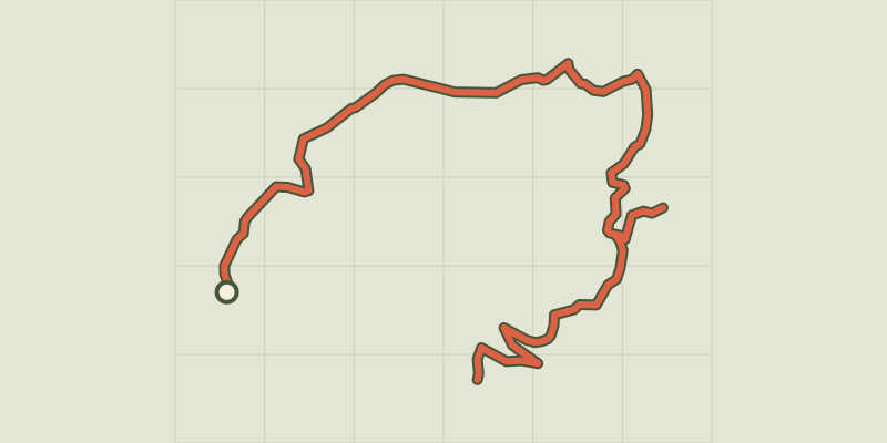
Gradient along the route: 5.3 km under 10% and 1.8 km at 10 to 20%. Elevation from 2,284 m to 2,678 m over 7.1 km.
Description
From Orcières Merlette or the summit of Le Drouvet with the hybrid lift, this trail is a great classic in the valley. Landscapes, fauna and flora - it’s all there, with a chance to enjoy a great experience and fill your head with memories. Lac des Estaris, at 2550m, is the biggest of the Orcières lakes and listed as a nature reserve. The descent then unveils the Jumeaux, Profond, Long and Sirènes lakes... Take the hybrid lift at the summit of Le Drouvet and make for Lac des Estaris (1 hr). Then continue on to the Jumeaux, Profond and Long Lakes. Carry on to the Chalet de Rocherousse. For the return, you take the hybrid lift from Rocherousse to the resort. Also possible to return on foot via Jujal, Pré La Baume, Forest des Estaris, then Orcières Merlette 1850.
Difficulty
Official rating: easy, by Parc national des Écrins.
Getting there
Start: Orcières Merlette 1850, Orcières (05).
Sources
- Track: Parc national des Écrins, Licence Ouverte 2.0, Licence Ouverte 2.0 (Etalab) (destination.ecrins-parcnational.fr/trek/950762-Les-lacs-d-Orcieres). Time estimated by GPX Path with the Mac app rule, breaks not included.
- Official elevation gain: 96 m, Parc national des Écrins
Nearby tracks

 © OpenStreetMap, SRTM · OpenTopoMap (CC-BY-SA)
From the Drouvet summit to Prapic
Écrins, Orcières (05) · Point to pointOfficial rating by Parc national des Écrins © OpenStreetMap, SRTM · OpenTopoMap (CC-BY-SA)
Col des Terres Blanches from Prapic
Écrins, Orcières (05) · Out and backOfficial rating by Parc national des Écrins © OpenStreetMap, SRTM · OpenTopoMap (CC-BY-SA)
Lac des Pisses
Écrins, Orcières (05) · Out and backOfficial rating by Parc national des Écrins © OpenStreetMap, SRTM · OpenTopoMap (CC-BY-SA)
The Saut du Laire
Écrins, Orcières (05) · Out and backOfficial rating by Parc national des Écrins © OpenStreetMap, SRTM · OpenTopoMap (CC-BY-SA)
The Poet’s tomb
Écrins, Orcières (05) · Out and backOfficial rating by Parc national des Écrins © OpenStreetMap, SRTM · OpenTopoMap (CC-BY-SA)
Tour du Grand Pinier
Écrins, Orcières (05) · Point to pointOfficial rating by Parc national des Écrins