
The balconies of Embrun

Key facts
- Distance
- 54.6 km
- Ascent
- +1,616 m
- Descent
- −1,483 m
- Estimated time
- 4 hr 25
- road cycling
- Difficulty
- Moderate
- official rating
- Route
- Loop
- back to the start
Profile and gradient
- under 10%
- 10 to 20%
- over 20%
Gradient along the route: 53.6 km under 10% and 1.0 km at 10 to 20%. Elevation from 781 m to 1,459 m over 54.6 km.
Description
From one bank of the Durance to the other, this route takes in the most beautiful views around Embrun. At the foot of Mont Guillaume, this route takes you to Caléyère and its breathtaking panorama of the Embrunais valleys, before crossing to the other side of the Durance and climbing up to the resort of Les Orres and its larch forests stretching as far as the eye can see. - From Embrun station, turn right and go over the railway line. Take the "Route de Caléyère", which rises very quickly. The climb lasts almost 5 km, before reaching the Château de Caléyère. Shortly afterwards, you can enjoy a moment's rest and a beautiful view of Lake Serre-Ponçon, the surrounding peaks and the various valleys. - Continue on a small road then descend towards Embrun, after passing through the hamlets of Les Barthelons and Les Maures as well as other residential areas. Follow the railway line, cross it at the level crossing, then turn right. Continue for 600m before turning left and leaving the D994h. Stay on this road until you take a left fork, then immediately right to join the route de la digue. - Go along the river veering right, with views over the citadel of Embrun. When you reach a footbridge, cross over the Durance. Follow the cycle path towards Baratier (short section under the N94) and head towards a roundabout. Take the third exit towards Les Orres (D40) and climb for 8 km before reaching an intersection. - From here, take the tarmac lane that heads off to the right towards Le Pont (D540). Join the Mélézet and then a much wider departmental road (D40). - Stay on this road going left, past a hairpin bend then downhill for 5 km. - Slightly after the hamlet of Rabast (sign near a bus stop), at the start of a curve, keep your eyes peeled for a right turn towards Les Gaillards. Then head to the church of Saint-Sauveur for a short stop to admire the breathtaking panorama. - Continue towards Crévoux for 4 km and join the D39 at a hairpin bend. - Then head towards Saint-André-d'Embrun and, 1 km before the village (on the D139), choose the small route that climbs to the right towards Les Lagiers. Continue for 2 km until you come to a hairpin bend, then turn left onto the D994d. Follow the signs for Embrun for 4 km and turn right at the STOP sign. Cross the Durance on a metal bridge (wooden floor) towards the citadel of Embrun. - Finally, take the last ascent back to the starting point.
Difficulty
Official rating: moderate, by Parc national des Écrins.
Getting there
Start: Parking de la Gare, Embrun, Embrun (05).
Sources
- Track: Parc national des Écrins, Licence Ouverte 2.0, Licence Ouverte 2.0 (Etalab) (destination.ecrins-parcnational.fr/trek/996011-Les-balcons-d-Embrun). Time estimated by GPX Path with the Mac app rule, breaks not included.
- Official elevation gain: 1,616 m, Parc national des Écrins
Nearby tracks

 © OpenStreetMap, SRTM · OpenTopoMap (CC-BY-SA)
From one bank of the Durance to the other
Écrins, Embrun (05) · LoopOfficial rating by Parc national des Écrins © OpenStreetMap, SRTM · OpenTopoMap (CC-BY-SA)
Right bank Serre-Ponçon
Écrins, Embrun (05) · LoopOfficial rating by Parc national des Écrins © OpenStreetMap, SRTM · OpenTopoMap (CC-BY-SA)
Around Lake Serre-Ponçon
Écrins, Embrun (05) · LoopOfficial rating by Parc national des Écrins © OpenStreetMap, SRTM · OpenTopoMap (CC-BY-SA)
Montée de la Draye
Écrins, Crots (05) · Point to pointOfficial rating by Parc national des Écrins © OpenStreetMap, SRTM · OpenTopoMap (CC-BY-SA)
Les Trois Rivières
Écrins, Savines-le-Lac (05) · LoopOfficial rating by Parc national des Écrins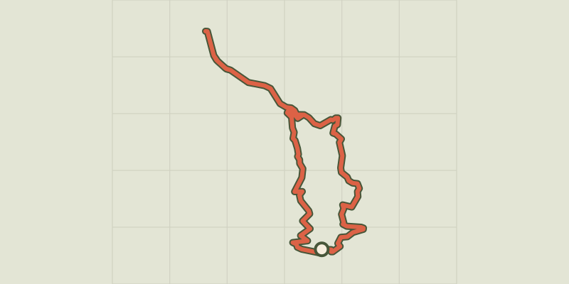 © OpenStreetMap, SRTM · OpenTopoMap (CC-BY-SA)
At the gateway to the Ecrins
Écrins, Savines-le-Lac (05) · LoopOfficial rating by Parc national des Écrins