
The short circuit of Grambois

Key facts
- Distance
- 1.9 km
- Ascent
- +76 m
- Descent
- −65 m
- Estimated time
- 35 min
- hiking
- Difficulty
- Very easy
- official rating
- Route
- Loop
- back to the start
Profile and gradient
- under 10%
- 10 to 20%
- over 20%
Gradient along the route: 1.2 km under 10%, 0.6 km at 10 to 20% and 0.1 km over 20%. Elevation from 306 m to 374 m over 1.9 km.
Description
Discovering the heritage and biodiversity of this small village of the Southern Luberon, which attracted the filmmaker Yves Robert. "Arriving at Grambois for the first time, I suddenly let myself be surprised by the sight of this village perched on a spur. Taking a picture was a must! Then immediately I went exploring the cobbled streets, trying to discover the history of this authentic village. At its peak, the beautiful view of the Eze Valley, the plain of the Pays d'Aigues and neighboring villages, finally seduced me." says Séverine Besson, Task Officer for the Valuation of assets at the south side Luberon Tourist Office. Head towards the bottom of the car park and take the gravel road to the left about twenty meters. Go into the driveway to the right and reach the fifth dovecote. 1- Take a left and head up the olive tree paths and reach the road (D122). Cross it and climb the Chemin de Fontsausse. Pass a curve around the spring at the foot of the rock and continue. Descend to the right the Rue de Ribas for 100m and climb the steep paved path to the left of Chemin des Pasquiers. On top of the hill, continue straight to the fountain with the three barrels. 2- Turn left, taking the stairs and come out on the Place des Remparts. Cross it then continue left to the town hall square. After the square, turn right and go down the paved street of Rue du Château. Continue to the right and cross the winding descent and pass the Porte de Fontvérane. Go up to the right the Rue de la Ferrage. 3- Before the calvary (cross) exit left the main street. 100m lower, hurtle down to the left the little staircase and then go left under a remarkable oak. Continue the path, go down a final series of steps and lead right to the Fontvérane source. Go down the wide path to the left. Leave behind the right trail (marked in green) and continue straight on the slope (GR markings) on about 200m. 4- In a right turn, take a left along a path overhanging the left bank of the Eze. Further down, go along an old meadow and climb slightly to the left (4 steps). Then continue into the undergrowth. Cross the road (D122) to regain the car park of the starting point
Difficulty
Official rating: very easy, by Parcs naturels régionaux de Provence-Alpes-Côte d'Azur.
Before you go
- Be careful when crossing the road after point 1, then at the end of the walk when heading back to the parking lot.
Getting there
Start: parking du pont du Moulin du Pas, Grambois, Grambois (84).
Sources
- Track: Parcs naturels régionaux de Provence-Alpes-Côte d'Azur (Chemins des Parcs), Licence Ouverte 2.0, Licence Ouverte 2.0 (Etalab) (www.cheminsdesparcs.fr/trek/49727-GRAMBOIS---Le-petit-tour-du-village). Time estimated by GPX Path with the Mac app rule, breaks not included.
- Official elevation gain: 76 m, Parcs naturels régionaux de Provence-Alpes-Côte d'Azur
Nearby tracks

 © OpenStreetMap, SRTM · OpenTopoMap (CC-BY-SA)
La Bastidonne - Chapelle Saint-Julien
Luberon, La Bastidonne (84) · Out and backOfficial rating by Parcs naturels régionaux de Provence-Alpes-Côte d'Azur © OpenStreetMap, SRTM · OpenTopoMap (CC-BY-SA)
Le Mourre Nègre, southern side
Luberon, Cabrières-d'Aigues (84) · LoopOfficial rating by Parcs naturels régionaux de Provence-Alpes-Côte d'Azur © OpenStreetMap, SRTM · OpenTopoMap (CC-BY-SA)
Geological trail
Luberon, Cabrières-d'Aigues (84) · LoopOfficial rating by Parcs naturels régionaux de Provence-Alpes-Côte d'Azur © OpenStreetMap, SRTM · OpenTopoMap (CC-BY-SA)
Beaumont-de-Pertuis - Entre collines boisées et cultures ancestrales
Luberon, Beaumont-de-Pertuis (84) · LoopOfficial rating by Parcs naturels régionaux de Provence-Alpes-Côte d'Azur © OpenStreetMap, SRTM · OpenTopoMap (CC-BY-SA)
Beaumont-de-Pertuis - L'eau des fontaines et Chapelle Sainte-Croix
Luberon, Beaumont-de-Pertuis (84) · Out and backOfficial rating by Parcs naturels régionaux de Provence-Alpes-Côte d'Azur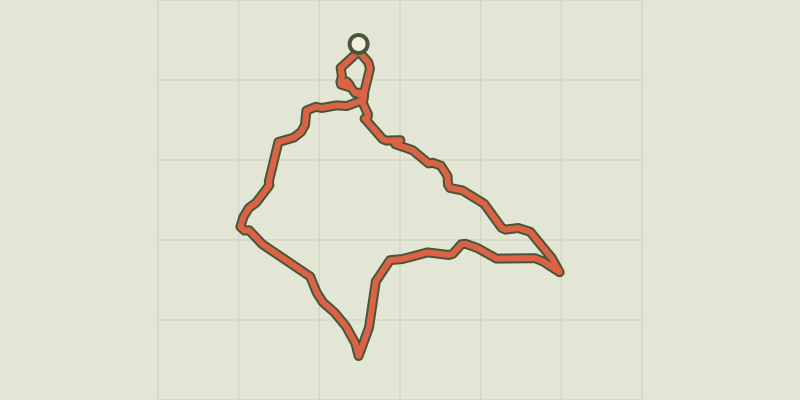 © OpenStreetMap, SRTM · OpenTopoMap (CC-BY-SA)
Landscapes of Ansouis
Luberon, Ansouis (84) · LoopOfficial rating by Parcs naturels régionaux de Provence-Alpes-Côte d'Azur