
The cliffs of the Causse Méjean

Key facts
- Distance
- 11.4 km
- Ascent
- +954 m
- Descent
- −681 m
- Estimated time
- 4 hr 10
- hiking
- Difficulty
- Moderate
- official rating
- Route
- Loop
- back to the start
Profile and gradient
- under 10%
- 10 to 20%
- over 20%
Gradient along the route: 7.4 km under 10%, 2.3 km at 10 to 20% and 1.7 km over 20%. Elevation from 403 m to 866 m over 11.4 km.
Description
A walk between the Jonte and Tarn gorges, with panoramic landscapes and, in the skies above, the four European vulture species that live on the Grands Causses plateaux. From the Place de la Mairie (town hall square) in Le Rozier, turn right then left in the village, and take the staircase between the houses on the left. Keep going uphill to the hamlet of Capluc. 1) At Capluc, you can choose to climb Capluc Rock (there and back, 30 min). If you do not, go past the bread oven and stay on the path that goes upstream in the Jonte gorge and continue to climb the hairpin bends of Echo Ravine. Ignore the path that goes downhill on the right. 2) At the crossroads, turn left and go uphill to the Col de Francbouteille pass. 3) At the pass, you go over into the Tarn valley. Turn right and take the path which more or less follows the contour line. 4) Turn right towards the Col de Cassagnes. At the first crossroads, go straight ahead, at the second turn right towards the Corniches de la Jonte. 5) Here, the track becomes a path. This runs along the cliff edge, passing Balcon du Vertige, Pas du Loup, Vase de Chine and Vase de Sèvres. 6) At the crossroads, turn left to go down to Capluc, from where you return on the same path.
Difficulty
Official rating: moderate, by Parc national des Cévennes.
Before you go
- This walk is not recommended for those suffering from vertigo (sections at cliff’s edge). Make sure your equipment is appropriate for the day’s weather conditions. Remember that the weather changes quickly in the mountains. Take enough water, wear sturdy shoes and put on a hat. Please close all gates and barriers behind you.
Getting there
Start: Le Rozier, Le Rozier (48).
Sources
- Track: Parc national des Cévennes, Licence Ouverte 1.0, Licence Ouverte 1.0 (Etalab) (destination.cevennes-parcnational.fr/trek/43387-Corniches-du-Mejean). Time estimated by GPX Path with the Mac app rule, breaks not included.
- Official elevation gain: 954 m, Parc national des Cévennes
Nearby tracks

 © OpenStreetMap, SRTM · OpenTopoMap (CC-BY-SA)
Saint-Pons hermitage
Occitanie, Le Rozier (48) · LoopOfficial rating by Parc national des Cévennes © OpenStreetMap, SRTM · OpenTopoMap (CC-BY-SA)
The arches of Saint-Pierre
Cévennes, Saint-Pierre-des-Tripiers (48) · LoopOfficial rating by Parc national des Cévennes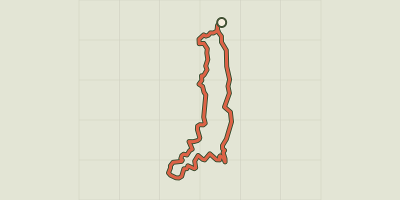 © OpenStreetMap, SRTM · OpenTopoMap (CC-BY-SA)
Baousse del Biel
Cévennes, Massegros Causses Gorges (48) · LoopOfficial rating by Parc national des Cévennes © OpenStreetMap, SRTM · OpenTopoMap (CC-BY-SA)
Voyage entre Gorges et Causse, au pays des vautours
Occitanie, Massegros Causses Gorges (48) · Point to pointOfficial rating by Parc national des Cévennes © OpenStreetMap, SRTM · OpenTopoMap (CC-BY-SA)
Roc Saint-Gervais
Occitanie, Hures-la-Parade (48) · LoopOfficial rating by Parc national des Cévennes © OpenStreetMap, SRTM · OpenTopoMap (CC-BY-SA)
Birds of the Causses and Gorges
Cévennes, La Malène (48) · LoopOfficial rating by Parc national des Cévennes