
Ascension Lake Loop
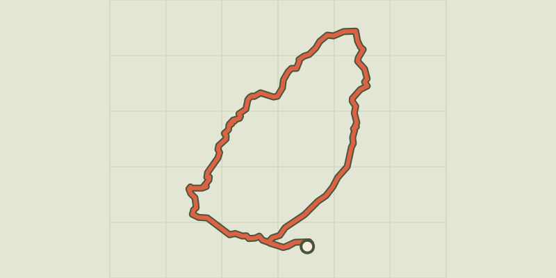
Key facts
- Distance
- 13.1 km
- Ascent
- +810 m
- Descent
- −780 m
- Estimated time
- 4 hr 50
- hiking
- Difficulty
- Moderate
- official rating
- Route
- Loop
- back to the start
Profile and gradient
- under 10%
- 10 to 20%
- over 20%
Gradient along the route: 7.2 km under 10%, 3.0 km at 10 to 20% and 3.0 km over 20%. Elevation from 1,794 m to 2,445 m over 13.1 km.
Description
A loop with varied atmospheres, mixing woodland, mountain lake and remarkable viewpoints! Nestled in a natural setting, this route will reveal the magnificent Lac de l'Ascension. From conifer forest to alpine valley, passing by the river, this loop offers a variety of atmospheres. An open view over the Durance valley and the majestic Mont Pelvoux will accompany you throughout this full-day journey. - At the Lauzet chalets, turn left onto a forest road that crosses the Bouchouse torrent via a footbridge. - At Le Giet, take the right-hand path signposted "lac de l'Ascension via le Peyron 2h15". Continue to the Collet du Peyron, Lac Escur and then Lac de l'Ascension. - After this last lake, keep to the left-hand path to reach the Alpavin mountain hut. - Continue descending to a junction at the small flat area of Pra Chapelle. Turn left onto a path that climbs back up 120m in elevation. - Continue straight ahead along the forest track to return to Le Lauzet.
Difficulty
Official rating: moderate, by Parc national des Écrins.
Before you go
- Check weather conditions before setting off on a hike Emergency contacts: Mountain Rescue: 112 Respect the work of farmers, landowners and property owners Close all gates behind you Take all your litter home Do not cut across meadows
Getting there
Start: Parking, Le Lauzet, La Roche-de-Rame (05).
Sources
- Track: Parc national des Écrins, Licence Ouverte 2.0, Licence Ouverte 2.0 (Etalab) (destination.ecrins-parcnational.fr/trek/995095-Circuit-du-lac-de-l-Ascension). Time estimated by GPX Path with the Mac app rule, breaks not included.
- Official elevation gain: 810 m, Parc national des Écrins
Nearby tracks

 © OpenStreetMap, SRTM · OpenTopoMap (CC-BY-SA)
Néal Lake and Néal Pass Circuit
Provence-Alpes-Côte d'Azur, La Roche-de-Rame (05) · LoopOfficial rating by Parc national des Écrins © OpenStreetMap, SRTM · OpenTopoMap (CC-BY-SA)
Lac du Lauzet - Saint-Crépin
Provence-Alpes-Côte d'Azur, Saint-Crépin (05) · Out and backOfficial rating by Parcs naturels régionaux de Provence-Alpes-Côte d'Azur © OpenStreetMap, SRTM · OpenTopoMap (CC-BY-SA)
Col Garnier par le Lac du Lauzet - Saint-Crépin
Provence-Alpes-Côte d'Azur, Saint-Crépin (05) · LoopOfficial rating by Parcs naturels régionaux de Provence-Alpes-Côte d'Azur © OpenStreetMap, SRTM · OpenTopoMap (CC-BY-SA)
THEMED PATH: The Serre-Duc Canal
Provence-Alpes-Côte d'Azur, La Roche-de-Rame (05) · LoopOfficial rating by Parc national des Écrins © OpenStreetMap, SRTM · OpenTopoMap (CC-BY-SA)
RANDOLAND : La Roche de Rame
Provence-Alpes-Côte d'Azur, La Roche-de-Rame (05) · LoopOfficial rating by Parc national des Écrins © OpenStreetMap, SRTM · OpenTopoMap (CC-BY-SA)
THEMED PATH: The precipice path
Écrins, Champcella (05) · LoopOfficial rating by Parc national des Écrins