
By bike, an unusual village in the Camargue
Key facts
- Distance
- 6.6 km
- Ascent
- +2 m
- Descent
- −0 m
- Estimated time
- 15 min
- road cycling
- Difficulty
- Very easy
- official rating
- Route
- Loop
- back to the start
Profile and gradient
- under 10%
- 10 to 20%
- over 20%
Gradient along the route: 6.6 km under 10%. Elevation from 2 m to 3 m over 6.6 km.
Description
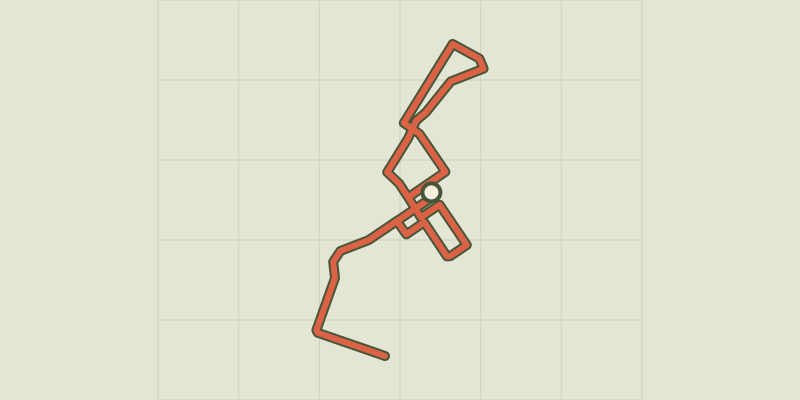
A stroll in the alleys of Salin-de-Giraud, whose architecture will transport you in a typical landscape of the north of France. Salin-de-Giraud fascinates and impresses with its long rectangular buildings with bricks imported from the north. Nicknamed "the coron of the south", the city was built on a chequerboard plan typical of the workers' cities of the second half of the 19th century. This route offers a walk in the heart of housing workers separated by public or private gardens. Browse the city to discover the old factory and its mansion. An atypical landscape in this Provencal environment! Departure from the Tourist Office: Back to the Tourist Office, head to the right. Turn right at the junction to reach the Boulevard de la Gare and continue on the boulevard. Departure from the Boulevard de la Gare car park : Go to the right, back to the car park, on the boulevard. 1 - At the roundabout, turn left. Continue on the Boulevard de la Camargue for 300 m, pass the Saint-Trophime Catholic Church and continue until Adrien Badin Square. After the bandstand, head to the left on Rue du Jeu de Mail. Continue straight for 400 m in the residential area until the Greek Orthodox Church. Then retrace your steps to Boulevard de la Gare. 2 - At the end of the Gardians square, located after the Boulevard de la Gare car park, head to the right then turn the second left on the rue des Ecoles. At the stop sign, turn right on the Rue des Arènes. 3 - turn left on Rue Mireille then, at the giving way sign, turn left towards Rue Pierre Tournayre. 4 - turn to the left on the Rue de la Provence. At the intersection with the Rue des Arènes, turn right. At the junction with the Boulevard de la Gare, cross straight ahead, leaving the bullring on the right. 5 - After the bullring, go to the right Rue Louis Pasteur and continue to the stop. 6- At the intersection with the D36, turn left and continue for 400 m After the traffic light and the bridge of the Giraud Canal, turn right on the C142 of the Barcarin Church. 7 - After the Barcarin Church, take the path along the river on the right. At the old Solvay loading platform, take the path to the right after the barrier that runs along the wall. This path allows to join the village by the Joseph Imbert avenue, take the first path on the right that leads to the Rue de la Victoire to return to the Tourist Office.
Difficulty
Official rating: very easy, by Parcs naturels régionaux de Provence-Alpes-Côte d'Azur.
Before you go
- Respect the road code on roads open to public traffic.
- Caution on the D36!
Getting there
Start: Office de tourisme, Salin-de-Giraud, Arles (13).
Sources
- Track: Parcs naturels régionaux de Provence-Alpes-Côte d'Azur (Chemins des Parcs), Licence Ouverte 2.0, Licence Ouverte 2.0 (Etalab) (www.cheminsdesparcs.fr/trek/15249-SALIN-DE-GIRAUD---A-velo%2C-un-village-insolite-en-Camargue). Time estimated by GPX Path with the Mac app rule, breaks not included.
- Official elevation gain: 2 m, Parcs naturels régionaux de Provence-Alpes-Côte d'Azur
Nearby tracks

 © OpenStreetMap, SRTM · OpenTopoMap (CC-BY-SA)
On the banks of the Rhône, by bike
Provence-Alpes-Côte d'Azur, Arles (13) · Point to pointOfficial rating by Parcs naturels régionaux de Provence-Alpes-Côte d'Azur © OpenStreetMap, SRTM · OpenTopoMap (CC-BY-SA)
Pink flamingos and salt while you bike
Provence-Alpes-Côte d'Azur, Arles (13) · LoopOfficial rating by Parcs naturels régionaux de Provence-Alpes-Côte d'Azur © OpenStreetMap, SRTM · OpenTopoMap (CC-BY-SA)
Port-Saint-Louis on bike, the city surrounded by water
Provence-Alpes-Côte d'Azur, Port-Saint-Louis-du-Rhône (13) · LoopOfficial rating by Parcs naturels régionaux de Provence-Alpes-Côte d'Azur © OpenStreetMap, SRTM · OpenTopoMap (CC-BY-SA)
Rice bike ride and Camargue horses
Provence-Alpes-Côte d'Azur, Arles (13) · LoopOfficial rating by Parcs naturels régionaux de Provence-Alpes-Côte d'Azur © OpenStreetMap, SRTM · OpenTopoMap (CC-BY-SA)
Cycling from Crau to the Vigueirat marshes.
Provence-Alpes-Côte d'Azur, Arles (13) · LoopOfficial rating by Parcs naturels régionaux de Provence-Alpes-Côte d'Azur © OpenStreetMap, SRTM · OpenTopoMap (CC-BY-SA)
Cycling around Saintes-Maries-de-la-Mer
Provence-Alpes-Côte d'Azur, Saintes-Maries-de-la-Mer (13) · LoopOfficial rating by Parcs naturels régionaux de Provence-Alpes-Côte d'Azur