
Port-Saint-Louis on bike, the city surrounded by water

Key facts
- Distance
- 9.3 km
- Ascent
- +1 m
- Descent
- −0 m
- Estimated time
- 25 min
- road cycling
- Difficulty
- Very easy
- official rating
- Route
- Loop
- back to the start
Profile and gradient
- under 10%
- 10 to 20%
- over 20%
Gradient along the route: 9.3 km under 10%. Elevation from 0 m to 0 m over 9.3 km.
Description
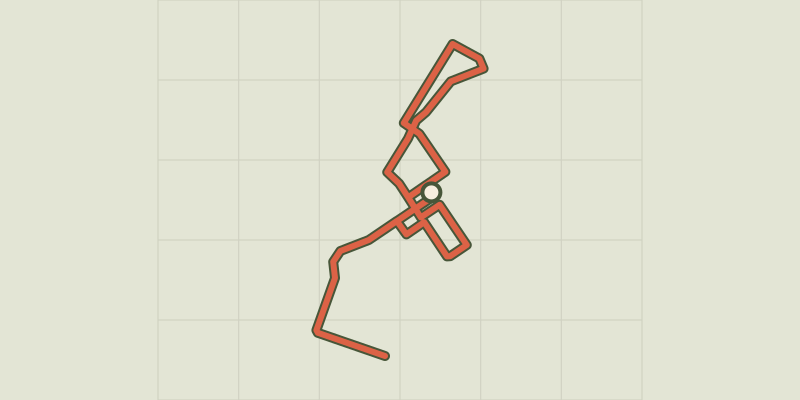
Ride along the mouth of the great Rhône, between the city "at the other end of the world'', the river and the sea... Port-Saint-Louis-du-Rhône, born around the port activity, has developed a new face. The Commune was included in the perimeter of the Regional Natural Park of Camargue in February 2011, offering its visitors the Camargue symbols: greater flamingos, horses, salt marshes, beaches ... It now relies on its natural heritage and its cultural identity to revitalize and value its territory, and by taking all necessary measuresto preserve the quality of life. From the Tour Saint-Louis, take the road “rue Pasteur”, join the dock “quai Bonnardel” and pass through the lock. 1- Take the bike path along the Saint-Louis Canal until the Port Navy Services. 2- At the intersection, turn left on the bicycle path and reach the beach of Carteau. 3- Turn around and go back to point 2. At the intersection, turn left. 4- Facing the canal, turn right. 5- At the roundabout, take the bicycle path in the direction of Port-Saint-Louis through the banks of the Rhône. 1- At point 1, turn left, go through the lock again and return to the starting point through the same route.
Difficulty
Official rating: very easy, by Parcs naturels régionaux de Provence-Alpes-Côte d'Azur.
Getting there
Start: Tour Saint-Louis, Port-Saint-Louis-du-Rhône, Port-Saint-Louis-du-Rhône (13).
Sources
- Track: Parcs naturels régionaux de Provence-Alpes-Côte d'Azur (Chemins des Parcs), Licence Ouverte 2.0, Licence Ouverte 2.0 (Etalab) (www.cheminsdesparcs.fr/trek/15306-PORT-SAINT-LOUIS-DU-RHONE---La-ville-entouree-d-eau-a-velo). Time estimated by GPX Path with the Mac app rule, breaks not included.
- Official elevation gain: 1 m, Parcs naturels régionaux de Provence-Alpes-Côte d'Azur
Nearby tracks
 © OpenStreetMap, SRTM · OpenTopoMap (CC-BY-SA)
By bike, an unusual village in the Camargue
Provence-Alpes-Côte d'Azur, Arles (13) · LoopOfficial rating by Parcs naturels régionaux de Provence-Alpes-Côte d'Azur © OpenStreetMap, SRTM · OpenTopoMap (CC-BY-SA)
On the banks of the Rhône, by bike
Provence-Alpes-Côte d'Azur, Arles (13) · Point to pointOfficial rating by Parcs naturels régionaux de Provence-Alpes-Côte d'Azur © OpenStreetMap, SRTM · OpenTopoMap (CC-BY-SA)
Pink flamingos and salt while you bike
Provence-Alpes-Côte d'Azur, Arles (13) · LoopOfficial rating by Parcs naturels régionaux de Provence-Alpes-Côte d'Azur © OpenStreetMap, SRTM · OpenTopoMap (CC-BY-SA)
Rice bike ride and Camargue horses
Provence-Alpes-Côte d'Azur, Arles (13) · LoopOfficial rating by Parcs naturels régionaux de Provence-Alpes-Côte d'Azur © OpenStreetMap, SRTM · OpenTopoMap (CC-BY-SA)
Cycling from Crau to the Vigueirat marshes.
Provence-Alpes-Côte d'Azur, Arles (13) · LoopOfficial rating by Parcs naturels régionaux de Provence-Alpes-Côte d'Azur © OpenStreetMap, SRTM · OpenTopoMap (CC-BY-SA)
Cycling around Saintes-Maries-de-la-Mer
Provence-Alpes-Côte d'Azur, Saintes-Maries-de-la-Mer (13) · LoopOfficial rating by Parcs naturels régionaux de Provence-Alpes-Côte d'Azur