
Le Lauzet circuit (trail route no. 8)
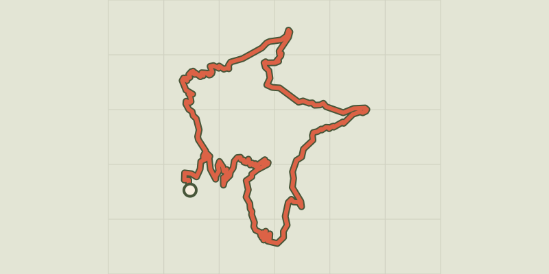
Key facts
- Distance
- 22.6 km
- Ascent
- +1,147 m
- Descent
- −1,104 m
- Estimated time
- 3 hr 20
- trail running
- Difficulty
- Easy
- official rating
- Route
- Loop
- back to the start
Profile and gradient
- under 10%
- 10 to 20%
- over 20%
Gradient along the route: 14.1 km under 10%, 7.5 km at 10 to 20% and 1.0 km over 20%. Elevation from 944 m to 1,936 m over 22.6 km.
Description
The Le Lauzet circuit is a loop taking you on a discovery of the multi-faceted features of a high alpine territory! Pine, fir and larch trees, forest roads, meadows and a mountain stream all combine to make this a highly varied trail. On the way to the chalets of Le Lauzet, this circuit is brimming with a harmonious variety of landscapes! Facing away from the entrance to the lake campsite, turn right to go through the village of La Roche-de-Rame along the Rue Les Queyras. After going past the cemetery, continue to the right. - Turn left. At the end of this track, at the D38 continue by turning right. A little further up, cross the bridge on the right. After the Bouchouse hydroelectric power station, turn left and take the path leading off to the right. Carry on along this path until you reach the Bel Pinet sector. - At the Bel Pinet sector, take the path on the right to start the descent. - As you approach the pink marble quarries, take the path on the left. This is a technical section. Then after a succession of hairpins, continue straight on towards Le Lauzet. - At the chalets in Le Lauzet, turn left onto a forest road. At Le Giet, continue straight ahead on a path which is technical in places. This brings you to the vast open pasture area of Pré Chapelle. - Take the track on the left running along the edge of a wood, the Bois du Sapet. In Le Puy, continue by taking the track on the right. - Continue to the right. You pass a succession of hairpins and come to La Roche-de-Rame, through the Barthéou district.
Difficulty
Official rating: easy, by Parc national des Écrins.
Before you go
- Before setting off, it is very important to check the opening periods for this route on the website: https://stationdetrail.com/fr/stations/le-pays-des-ecrins/parcours
- Share your photographs on social networks with #stationdetrailecrins
- Check weather conditions before setting off.
- Rescue services contact details: Secours Montagne (Mountain Rescue): +33 (0)4 92 22 22 22 or 112
- Show consideration for the work of farmers, livestock keepers and owners
- Close all gates behind you
- Take your litter home
- Do not take shortcuts across pastureland
- The trail routes are also suitable for walking
Getting there
Start: Camping du lac, La Roche-de-Rame, La Roche-de-Rame (05).
Sources
- Track: Parc national des Écrins, Licence Ouverte 2.0, Licence Ouverte 2.0 (Etalab) (destination.ecrins-parcnational.fr/trek/959538-Trail-N08---Le-Lauzet). Time estimated by GPX Path with the Mac app rule, breaks not included.
- Official elevation gain: 1,147 m, Parc national des Écrins
Nearby tracks

 © OpenStreetMap, SRTM · OpenTopoMap (CC-BY-SA)
Marbre Rose circuit (trail route no. 3)
Provence-Alpes-Côte d'Azur, La Roche-de-Rame (05) · LoopOfficial rating by Parc national des Écrins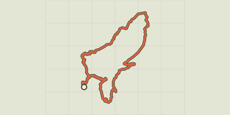 © OpenStreetMap, SRTM · OpenTopoMap (CC-BY-SA)
Les Lacs circuit (trail route no. 11)
Provence-Alpes-Côte d'Azur, La Roche-de-Rame (05) · LoopOfficial rating by Parc national des Écrins © OpenStreetMap, SRTM · OpenTopoMap (CC-BY-SA)
Entrainement - Atelier technique - La Roche-de-Rame
Provence-Alpes-Côte d'Azur, La Roche-de-Rame (05) · LoopOfficial rating by Parc national des Écrins © OpenStreetMap, SRTM · OpenTopoMap (CC-BY-SA)
Entrainement - Boucle Longue - Freissinières
Écrins, Freissinières (05) · LoopOfficial rating by Parc national des Écrins © OpenStreetMap, SRTM · OpenTopoMap (CC-BY-SA)
Kilomètre Vertical - Freissinières
Écrins, Freissinières (05) · Out and backOfficial rating by Parc national des Écrins © OpenStreetMap, SRTM · OpenTopoMap (CC-BY-SA)
Maxi Goureng (trail route no. 14)
Écrins, Freissinières (05) · LoopOfficial rating by Parc national des Écrins