
Marbre Rose circuit (trail route no. 3)

Key facts
- Distance
- 10.0 km
- Ascent
- +560 m
- Descent
- −538 m
- Estimated time
- 1 hr 35
- trail running
- Difficulty
- Very easy
- official rating
- Route
- Loop
- back to the start
Profile and gradient
- under 10%
- 10 to 20%
- over 20%
Gradient along the route: 5.5 km under 10%, 3.8 km at 10 to 20% and 0.8 km over 20%. Elevation from 944 m to 1,482 m over 10.0 km.
Description
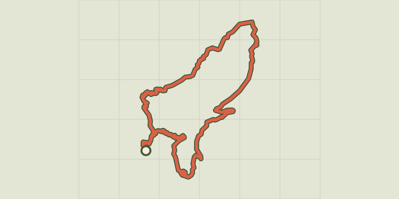
Running alternately through pine forest, aspens and lavender, this promises to be a delightful route The route rises gently through the village, along a path and a forest track. When you reach the foot of the Oumbras (1,769 m), you will start a long traverse section overlooking the Durance valley. The descent then leads through Scots pines. Take a pretty single track which passes close by the pink marble quarry of Combe-Mounière. The marble from here was used in the construction of Gap Cathedral. You return to the village along a path running above the lake. Facing away from the entrance to the lake campsite, turn right to go through the village of La Roche-de-Rame along the Rue “Les Queyras”. After going past the cemetery, continue to the right. - Turn left. At the end of this track, at the D38 continue by turning right. A short distance further up, cross the bridge on the right after the Bouchouse hydroelectric power station. The route gradually rises until it runs at a height above the lake. - At the Bel Pinet sector, take the track on the right to start the descent. - Where the tracks intersect, take the right-hand track to tackle the descent. - At the next intersection, continue on the path on the right - When you are back on the forest track, take a path running downhill below the hairpin and this brings you back to your starting point.
Difficulty
Official rating: very easy, by Parc national des Écrins.
Before you go
- Before setting off, it is very important to check the opening periods for this route on the website: https://stationdetrail.com/fr/stations/le-pays-des-ecrins/parcours
- Share your photographs on social networks with #stationdetrailecrins
- Check weather conditions before setting off.
- Rescue services contact details: Secours Montagne (Mountain Rescue): +33 (0)4 92 22 22 22 or 112
- Show consideration for the work of farmers, livestock keepers and owners
- Close all gates behind you
- Take your litter home
- Do not take shortcuts across pastureland
- The trail routes are also suitable for walking
Getting there
Start: Camping du lac, La Roche-de-Rame, La Roche-de-Rame (05).
Sources
- Track: Parc national des Écrins, Licence Ouverte 2.0, Licence Ouverte 2.0 (Etalab) (destination.ecrins-parcnational.fr/trek/959534-Trail-N03---Circuit-du-Marbre-Rose). Time estimated by GPX Path with the Mac app rule, breaks not included.
- Official elevation gain: 560 m, Parc national des Écrins
Nearby tracks
 © OpenStreetMap, SRTM · OpenTopoMap (CC-BY-SA)
Les Lacs circuit (trail route no. 11)
Provence-Alpes-Côte d'Azur, La Roche-de-Rame (05) · LoopOfficial rating by Parc national des Écrins © OpenStreetMap, SRTM · OpenTopoMap (CC-BY-SA)
Le Lauzet circuit (trail route no. 8)
Provence-Alpes-Côte d'Azur, La Roche-de-Rame (05) · LoopOfficial rating by Parc national des Écrins © OpenStreetMap, SRTM · OpenTopoMap (CC-BY-SA)
Entrainement - Atelier technique - La Roche-de-Rame
Provence-Alpes-Côte d'Azur, La Roche-de-Rame (05) · LoopOfficial rating by Parc national des Écrins © OpenStreetMap, SRTM · OpenTopoMap (CC-BY-SA)
Entrainement - Boucle Longue - Freissinières
Écrins, Freissinières (05) · LoopOfficial rating by Parc national des Écrins © OpenStreetMap, SRTM · OpenTopoMap (CC-BY-SA)
Kilomètre Vertical - Freissinières
Écrins, Freissinières (05) · Out and backOfficial rating by Parc national des Écrins © OpenStreetMap, SRTM · OpenTopoMap (CC-BY-SA)
Maxi Goureng (trail route no. 14)
Écrins, Freissinières (05) · LoopOfficial rating by Parc national des Écrins