
Loop 58 - Tour of Crévoux

Key facts
- Distance
- 28.1 km
- Ascent
- +924 m
- Descent
- −886 m
- Estimated time
- 2 hr 50
- gravel
- Difficulty
- Moderate
- official rating
- Route
- Loop
- back to the start
Profile and gradient
- under 10%
- 10 to 20%
- over 20%
Gradient along the route: 25.1 km under 10% and 3.0 km at 10 to 20%. Elevation from 1,098 m to 1,963 m over 28.1 km.
Description
Crévoux is the highest village in the Communauté de Commune de Serre-Ponçon. Enjoy the peace and quiet, the shady slopes and the hamlets along the eponymous stream. An extension of the Méale route, the Crévoux loop continues under the larches on the side of the Crévoux valley. It passes through a series of viewpoints and a string of hamlets before returning to the village-resort. - From the village square, take the street leading from the war memorial. At "Champ La font 2", climb the gravel track towards the hamlet of La Chalp. Continue straight ahead on the main road. At Travers du Moulin go straight up the track. - At the bend continue straight ahead (stony ascent). At the bend in the road (D39T), turn right. - At the picnic area, take two right turns. Stay on the main hairpin path. - Take the descent, and turn right at the bend of a track. At the crossroads, continue straight ahead (quick return possible on the right along the blue route 57) - At the crossroads of the DFCI track H24, descend to the right. At Faravelle continue straight downhill then turn right. At the junction (at the end of the flat track), turn right and stay on the main track. - At Les Gaillards, turn right down the road towards Saint-Sauveur. At the church of Saint-Sauveur, turn right onto the road. - Turn right through the hamlet of "Coin haut" and then "Vabres", staying on the main road. At the bend in the D39, turn right towards Crévoux. - At the D139, climb the road to the right towards the resort of Crévoux. Return to the car park.
Difficulty
Official rating: moderate, by Parc national des Écrins.
Getting there
Start: Crévoux, Crévoux (05).
Sources
- Track: Parc national des Écrins, Licence Ouverte 2.0, Licence Ouverte 2.0 (Etalab) (destination.ecrins-parcnational.fr/trek/996158-Boucle-58---Le-tour-de-Crevoux). Time estimated by GPX Path with the Mac app rule, breaks not included.
- Official elevation gain: 924 m, Parc national des Écrins
Nearby tracks

 © OpenStreetMap, SRTM · OpenTopoMap (CC-BY-SA)
Loop 27 - The Col du Parpaillon
Provence-Alpes-Côte d'Azur, Crévoux (05) · Out and backOfficial rating by Parc national des Écrins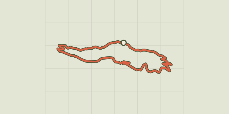 © OpenStreetMap, SRTM · OpenTopoMap (CC-BY-SA)
Loop 57 - Le Méale
Provence-Alpes-Côte d'Azur, Crévoux (05) · LoopOfficial rating by Parc national des Écrins © OpenStreetMap, SRTM · OpenTopoMap (CC-BY-SA)
Loop 56 - Col Valbelle
Provence-Alpes-Côte d'Azur, Saint-André-d'Embrun (05) · LoopOfficial rating by Parc national des Écrins © OpenStreetMap, SRTM · OpenTopoMap (CC-BY-SA)
Loop 55 - Lac du Siguret
Provence-Alpes-Côte d'Azur, Saint-André-d'Embrun (05) · LoopOfficial rating by Parc national des Écrins © OpenStreetMap, SRTM · OpenTopoMap (CC-BY-SA)
Around Lake Serre-Ponçon - Gravel
Écrins, Embrun (05) · Point to pointOfficial rating by Parc national des Écrins © OpenStreetMap, SRTM · OpenTopoMap (CC-BY-SA)
Loop 59 - From Embrun to Les Orres
Provence-Alpes-Côte d'Azur, Embrun (05) · LoopOfficial rating by Parc national des Écrins