
The balconies of Saint-André d'Embrun

Key facts
- Distance
- 23.1 km
- Ascent
- +548 m
- Descent
- −498 m
- Estimated time
- 1 hr 40
- road cycling
- Difficulty
- Easy
- official rating
- Route
- Loop
- back to the start
Profile and gradient
- under 10%
- 10 to 20%
- over 20%
Gradient along the route: 23.1 km under 10%. Elevation from 781 m to 1,210 m over 23.1 km.
Description
A gentle loop! The peaceful banks of the Durance give way to a more undulating landscape with views of the Embrunais mountains and the turquoise waters of the lake. The panoramic view from the heights is sure to be the highlight of this itinerary. The views of Lake Serre-Ponçon, the Durance valley and Embrun are well worth the effort. You'll also pass through typical hamlets with a certain charm. - From the church, take the road downhill to join the D994d. Then turn left towards Embrun. Drive for 4 km and, at the STOP sign, turn right and cross the Durance on a metal bridge (wooden floor) towards Embrun. Quickly, turn left and follow the route de la Digue, which is closed to vehicles. - The road runs alongside the river and provides a view of Embrun's citadel. Reach a footbridge and cross back over the Durance. Follow the cycle path towards Baratier (short section under the N94) and head towards a roundabout. - Take the third exit towards Les Orres (D40) and climb for 4km before reaching a fork. Now turn left onto the D39a towards Saint-Sauveur. You'll be rewarded with some beautiful views of the lake as you pedal along. Once in Saint-Sauveur, make a short stop to admire the breathtaking panorama. - Continue on this balcony road for 4 km, joining the D39 at a hairpin bend. Turn left towards Saint-André-d'Embrun to return to the starting point.
Difficulty
Official rating: easy, by Parc national des Écrins.
Getting there
Start: Saint-André-d’Embrun, Saint-André-d'Embrun (05).
Sources
- Track: Parc national des Écrins, Licence Ouverte 2.0, Licence Ouverte 2.0 (Etalab) (destination.ecrins-parcnational.fr/trek/996009-Les-balcons-de-Saint-Andre-d-Embrun). Time estimated by GPX Path with the Mac app rule, breaks not included.
- Official elevation gain: 548 m, Parc national des Écrins
Nearby tracks

 © OpenStreetMap, SRTM · OpenTopoMap (CC-BY-SA)
The balconies of Embrun
Écrins, Embrun (05) · LoopOfficial rating by Parc national des Écrins © OpenStreetMap, SRTM · OpenTopoMap (CC-BY-SA)
From one bank of the Durance to the other
Écrins, Embrun (05) · LoopOfficial rating by Parc national des Écrins © OpenStreetMap, SRTM · OpenTopoMap (CC-BY-SA)
Right bank Serre-Ponçon
Écrins, Embrun (05) · LoopOfficial rating by Parc national des Écrins © OpenStreetMap, SRTM · OpenTopoMap (CC-BY-SA)
Around Lake Serre-Ponçon
Écrins, Embrun (05) · LoopOfficial rating by Parc national des Écrins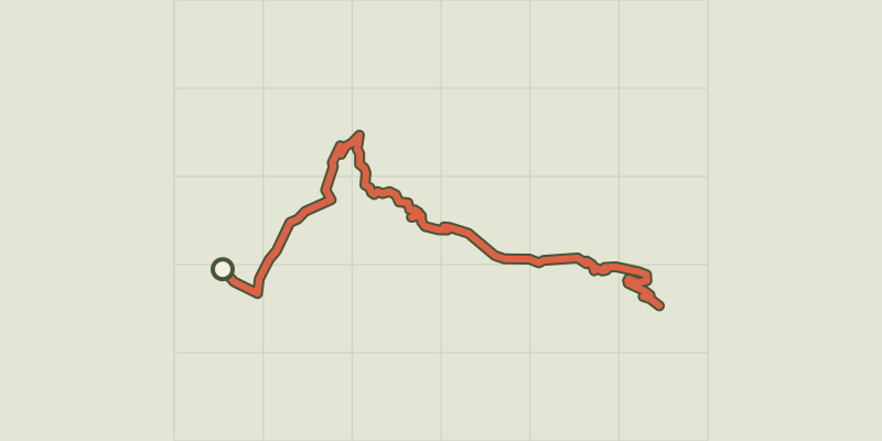 © OpenStreetMap, SRTM · OpenTopoMap (CC-BY-SA)
Montée de Crévoux
Provence-Alpes-Côte d'Azur, Baratier (05) · Point to pointOfficial rating by Parc national des Écrins © OpenStreetMap, SRTM · OpenTopoMap (CC-BY-SA)
Montée des Orres
Provence-Alpes-Côte d'Azur, Baratier (05) · Point to pointOfficial rating by Parc national des Écrins