
The Grand Pastre
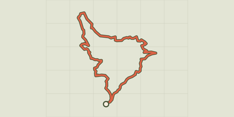
Key facts
- Distance
- 13.0 km
- Ascent
- +631 m
- Descent
- −592 m
- Estimated time
- 4 hr 10
- hiking
- Difficulty
- Moderate
- official rating
- Route
- Loop
- back to the start
Profile and gradient
- under 10%
- 10 to 20%
- over 20%
Gradient along the route: 7.8 km under 10% and 5.2 km at 10 to 20%. Elevation from 1,358 m to 1,709 m over 13.0 km.
Description
Follow in the ancient footsteps of the shepherds, along the « Lou Pastre » path from Les Orres, passing through forest, hamlets and alpine pastures. Starting from the ski resort of Les Orres, this trail is divided into several thematic sections. Follow the course of history thanks to the various interpretation panels provided along the way. You first go through the forest to reach the alpine pastures offering numerous vantage points over the valley of Les Orres and the Lac de Serre-Ponçon. From the car park follow signs for the Lou Pastre long loop (« Lou Pastre Grande Boucle »). After a few metres, continue straight ahead.
Difficulty
Official rating: moderate, by Parc national des Écrins.
Getting there
Start: Les Orres 1650, Les Orres (05).
Sources
- Track: Parc national des Écrins, Licence Ouverte 2.0, Licence Ouverte 2.0 (Etalab) (destination.ecrins-parcnational.fr/trek/974540-Lou-Pastre). Time estimated by GPX Path with the Mac app rule, breaks not included.
- Official elevation gain: 631 m, Parc national des Écrins
Nearby tracks

 © OpenStreetMap, SRTM · OpenTopoMap (CC-BY-SA)
Lake Sainte Marguerite
Provence-Alpes-Côte d'Azur, Les Orres (05) · LoopOfficial rating by Parc national des Écrins © OpenStreetMap, SRTM · OpenTopoMap (CC-BY-SA)
Sources de Jérusalem (Jerusalem Springs)
Provence-Alpes-Côte d'Azur, Les Orres (05) · LoopOfficial rating by Parc national des Écrins © OpenStreetMap, SRTM · OpenTopoMap (CC-BY-SA)
Vallon de Muretier
Provence-Alpes-Côte d'Azur, Les Orres (05) · Out and backOfficial rating by Parc national des Écrins © OpenStreetMap, SRTM · OpenTopoMap (CC-BY-SA)
Le Méale
Provence-Alpes-Côte d'Azur, Saint-Sauveur (05) · LoopOfficial rating by Parc national des Écrins © OpenStreetMap, SRTM · OpenTopoMap (CC-BY-SA)
Col des Orres
Provence-Alpes-Côte d'Azur, Les Orres (05) · Out and backOfficial rating by Parc national des Écrins © OpenStreetMap, SRTM · OpenTopoMap (CC-BY-SA)
l'Aupillon
Provence-Alpes-Côte d'Azur, Les Orres (05) · Out and backOfficial rating by Parc national des Écrins