
La Croix des Pins

Key facts
- Distance
- 11.7 km
- Ascent
- +431 m
- Descent
- −397 m
- Estimated time
- 3 hr 25
- hiking
- Difficulty
- Moderate
- official rating
- Route
- Loop
- back to the start
Profile and gradient
- under 10%
- 10 to 20%
- over 20%
Gradient along the route: 8.8 km under 10% and 2.9 km at 10 to 20%. Elevation from 496 m to 875 m over 11.7 km.
Description
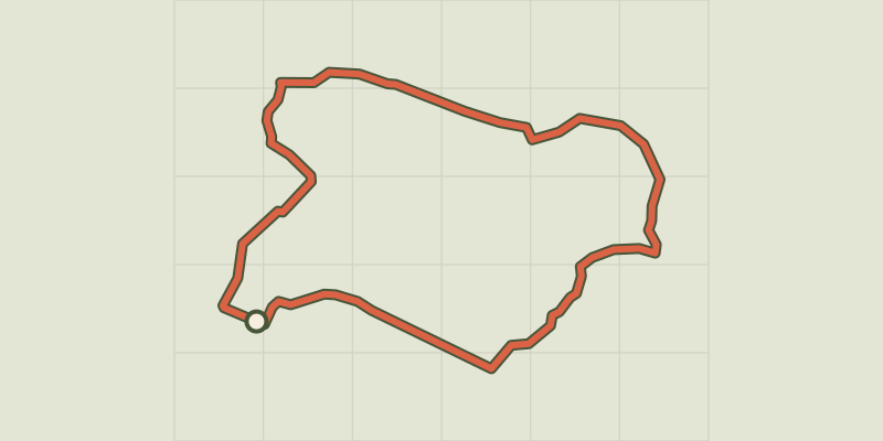
Aups, character village nestled at the foot of the Espiguières mountain in a privileged environment with rich heritage. A hike that begins with the old streets of Aupsùs village, full of heritage and historical riches, then you will follow the circuit of the chapels to finally climb up to the Croix des Pins where you will discover a nice view on the village, the lowlands and the Var summits. From the tourist office, pass the St-Pancrace church and walk up Aups through the medieval streets (attention, the yellow markings begins at point (1). Pass at the foot of the Tour de l'Horloge, follow the Aires street and exit the ramparts through Aires Portal Turn left and follow the road to the chapel of Notre-Dame de la Délivrance and then, on the other side of the road, on the rural path of Devensaux. 1- At 150 m, leave the small road and turn right on chemin de la Trinité. The dirt road becomes tarred after college. Climb up by the path to the chapel Sainte-Trinité, pass below, and join a dirt road to the first caves of Aups. Continue on the road for another 300 m to reach, nestled in the wall, the Sainte-Magdeleine chapel. Continue the route under the green oaks, and follow a low wall to reach an intersection. 2 - Go back along the path to the valley on the left and access the forest track. Take the track on the right. Continue for 1 km, then join a cistern and the junction with the track of the Grand Colle. Follow it on the left. It is tarred for 400 m, then continue on the dirt road to the Col de Brès. 3 - Just before the Col de Brès, climb on the path to the left. The climb lasts 800 m to the top of the Espiguières mountain. The path continues on the plateau up to a tank (1 km). 4 - Take a small path on the left in the woods to quickly reach the Croix des Pins (round trip). Return to the track and continue the crossing. Go down the path through the forest and then join the forest path of Croix des Pins at 1.7 km. 5 - On the track turn to the right and 800 m later turn left on the small Devensaux road. Return by the latter to the village and lead in point 1. Continue on the road up to the Aups’s doors. Return to the starting point by the small streets of the village.
Difficulty
Official rating: moderate, by Parcs naturels régionaux de Provence-Alpes-Côte d'Azur.
Before you go
- Provide 3L of water minimum per person, a hat and walking shoes. Consult the map of fire risks in the link "know more" during the summer period from 15 June - 15 September. Preferred seasons : All. But leave early in the morning to avoid the strong summer heats.
Getting there
Start: Office de tourisme, Aups, Aups (83).
Sources
- Track: Parcs naturels régionaux de Provence-Alpes-Côte d'Azur (Chemins des Parcs), Licence Ouverte 2.0, Licence Ouverte 2.0 (Etalab) (www.cheminsdesparcs.fr/trek/36922-AUPS---La-Croix-des-Pins). Time estimated by GPX Path with the Mac app rule, breaks not included.
- Official elevation gain: 431 m, Parcs naturels régionaux de Provence-Alpes-Côte d'Azur
Nearby tracks
 © OpenStreetMap, SRTM · OpenTopoMap (CC-BY-SA)
The cave path
Verdon, Aups (83) · LoopOfficial rating by Parcs naturels régionaux de Provence-Alpes-Côte d'Azur © OpenStreetMap, SRTM · OpenTopoMap (CC-BY-SA)
The Notre-Dame de Liesse Chapel
Verdon, Aups (83) · LoopOfficial rating by Parcs naturels régionaux de Provence-Alpes-Côte d'Azur © OpenStreetMap, SRTM · OpenTopoMap (CC-BY-SA)
The Plain (forest)
Verdon, Moissac-Bellevue (83) · LoopOfficial rating by Parcs naturels régionaux de Provence-Alpes-Côte d'Azur © OpenStreetMap, SRTM · OpenTopoMap (CC-BY-SA)
The Pelenc forest from Moissac Bellevue
Verdon, Moissac-Bellevue (83) · LoopOfficial rating by Parcs naturels régionaux de Provence-Alpes-Côte d'Azur © OpenStreetMap, SRTM · OpenTopoMap (CC-BY-SA)
The Pelenc forest from Régusse
Verdon, Régusse (83) · LoopOfficial rating by Parcs naturels régionaux de Provence-Alpes-Côte d'Azur © OpenStreetMap, SRTM · OpenTopoMap (CC-BY-SA)
La Colle (hill)
Verdon, Régusse (83) · LoopOfficial rating by Parcs naturels régionaux de Provence-Alpes-Côte d'Azur