
St. Mark's Chapel
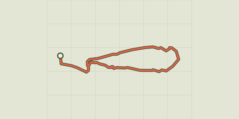
Key facts
- Distance
- 2.8 km
- Ascent
- +126 m
- Descent
- −123 m
- Estimated time
- 55 min
- hiking
- Difficulty
- Very easy
- official rating
- Route
- Loop
- back to the start
Profile and gradient
- under 10%
- 10 to 20%
- over 20%
Gradient along the route: 1.7 km under 10%, 0.9 km at 10 to 20% and 0.2 km over 20%. Elevation from 418 m to 543 m over 2.8 km.
Description
At Allemagne-en-Provence, follow the trail of a past rich in knightly history! This walk is an opportunity to explore buildings full of history including: the castle of Allemagne-en-Provence, St. Mark's chapel, around which, every spring, the villagers meet for a festive day. Along the way, you'll come across the tomb of a former baron ... The one of Allemagne-en-Provence, who died here during the French Wars of Religion. From the Place du 16 Juin 1944 (square), at the foot of the castle of Allemagne, follow the D952 towards Riez. Immediately after the bridge of the Tartavel valley, take the small path on the right, marked in yellow. 1- Go up by the footpath, under the oaks, amidst the thyme, boxwood and broom. Halfway up, pass at the foot of a column and continue in the woods until the chapel (equipped picnic area). 2- From the top, go back down through Allemagne-en-Provence by a wider path behind the chapel until the Route de Riez. The end of the trail follows the D952 for 500m (watch out for cars, walk to the right of the road!). Go past the old mill village, now converted into a hotel and restaurant. Reach the car park of the starting point.
Difficulty
Official rating: very easy, by Parcs naturels régionaux de Provence-Alpes-Côte d'Azur.
Before you go
- We recommend bringing water, a hat and proper hiking shoes. Avoid high summer temperatures, leave early.
Getting there
Start: Place du 16 juin 1944, Allemagne-en-Provence, Allemagne-en-Provence (04).
Sources
- Track: Parcs naturels régionaux de Provence-Alpes-Côte d'Azur (Chemins des Parcs), Licence Ouverte 2.0, Licence Ouverte 2.0 (Etalab) (www.cheminsdesparcs.fr/trek/54292-ALLEMAGNE-EN-PROVENCE---Du-chateau-a-la-chapelle-Saint-Marc). Time estimated by GPX Path with the Mac app rule, breaks not included.
- Official elevation gain: 126 m, Parcs naturels régionaux de Provence-Alpes-Côte d'Azur
Nearby tracks

 © OpenStreetMap, SRTM · OpenTopoMap (CC-BY-SA)
Buffe Arnaud Walk
Verdon, Saint-Martin-de-Brômes (04) · LoopOfficial rating by Parcs naturels régionaux de Provence-Alpes-Côte d'Azur © OpenStreetMap, SRTM · OpenTopoMap (CC-BY-SA)
From Séouve to Sainte-Magdeleine
Verdon, Esparron-de-Verdon (04) · LoopOfficial rating by Parcs naturels régionaux de Provence-Alpes-Côte d'Azur © OpenStreetMap, SRTM · OpenTopoMap (CC-BY-SA)
Esparron-de-Verdon - Autour de la Colle
Verdon, Esparron-de-Verdon (04) · LoopOfficial rating by Parcs naturels régionaux de Provence-Alpes-Côte d'Azur © OpenStreetMap, SRTM · OpenTopoMap (CC-BY-SA)
The Botanical Trail
Verdon, Esparron-de-Verdon (04) · LoopOfficial rating by Parcs naturels régionaux de Provence-Alpes-Côte d'Azur © OpenStreetMap, SRTM · OpenTopoMap (CC-BY-SA)
The Trinity
Verdon, Valensole (04) · LoopOfficial rating by Parcs naturels régionaux de Provence-Alpes-Côte d'Azur © OpenStreetMap, SRTM · OpenTopoMap (CC-BY-SA)
Montagnac - MONTPEZAT - Le circuit des deux oratoires
Verdon, Montagnac-Montpezat (04) · LoopOfficial rating by Parcs naturels régionaux de Provence-Alpes-Côte d'Azur