
The peak of Mount Crémon

Key facts
- Distance
- 13.9 km
- Ascent
- +912 m
- Descent
- −888 m
- Estimated time
- 5 hr 20
- hiking
- Difficulty
- Difficult
- official rating
- Route
- Out and back
- same way back
Profile and gradient
- under 10%
- 10 to 20%
- over 20%
Gradient along the route: 6.9 km under 10%, 4.2 km at 10 to 20% and 2.8 km over 20%. Elevation from 931 m to 1,751 m over 13.9 km.
Description
Breathtaking view of Lake Castillon. Early morning on a clear day, you can see from the top of Mount Cremon (1760m) Corsica, the gap from the Gorges of Verdon in the southwest and Mount Chiran with the observatory of Haute-Provence in the west. 1 - Take the trail rising above the road heading to Mount Crémon, across the picnic area. When coming out on a track, follow it at the rise, following a hairpin bend to the right. After 100m, take the left path. stroll under the pines and reach the track again (cross it). Then the climb becomes less steep. Follow the track under the larches and reach a large flat area at the border between the sunny and shaded slopes (a spring below, behind the slope of the track). 2 - Follow the track across for 50m, then exit it to the left and take a trail rising regularly in the slope parallel to the track. After crossing two ravines and following some hairpin bends, come out on the Demandolx mountain pass at 1.5km. 3 - At the mountain pass, follow the trail to the left for 1 km / less than a mile. Then leave it when reaching the right slope. Stroll along the route which remains flat for a good while. Reach the ridge of Mount Crémon. 4 - Leave the main trail and turn right onto a narrow path. Follow the route through the ridge and climb to the top. Perform the last 400m of vertical drop first in the undergrowth and then in the pastures. To the top of Mount Cremon at the mountain pass cycling milestone (1760m). 5 - The same route is used for the return.
Difficulty
Official rating: difficult, by Parcs naturels régionaux de Provence-Alpes-Côte d'Azur.
Before you go
- Avoid high summer temperatures, leave early. We recommend: 2L of water per person, a hat and proper hiking shoes. An abyss at the ridge of the western slope.
Getting there
Start: Aire de pique-nique D955, Saint-Julien-du-Verdon, Saint-Julien-du-Verdon (04).
Sources
- Track: Parcs naturels régionaux de Provence-Alpes-Côte d'Azur (Chemins des Parcs), Licence Ouverte 2.0, Licence Ouverte 2.0 (Etalab) (www.cheminsdesparcs.fr/trek/33758-SAINT-JULIEN-DU-VERDON---Le-sommet-du-Cremon). Time estimated by GPX Path with the Mac app rule, breaks not included.
- Official elevation gain: 912 m, Parcs naturels régionaux de Provence-Alpes-Côte d'Azur
Nearby tracks
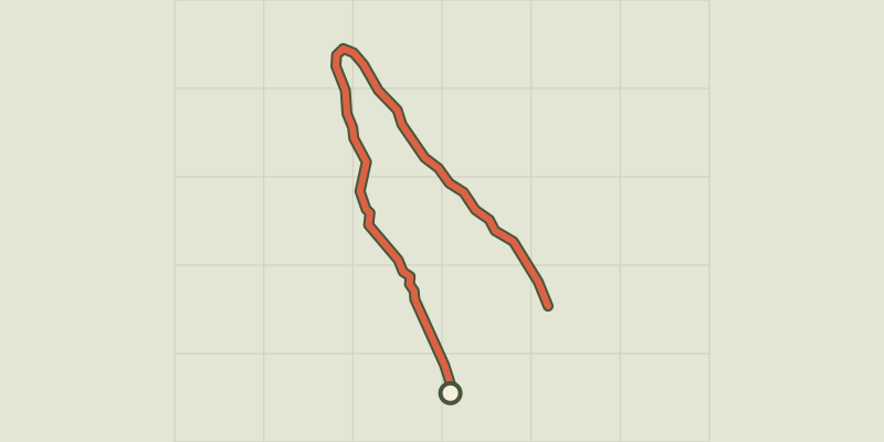
 © OpenStreetMap, SRTM · OpenTopoMap (CC-BY-SA)
Barre du Pidanoux
Verdon, Saint-Julien-du-Verdon (04) · Out and backOfficial rating by Parcs naturels régionaux de Provence-Alpes-Côte d'Azur © OpenStreetMap, SRTM · OpenTopoMap (CC-BY-SA)
The burnt farm
Verdon, Demandolx (04) · LoopOfficial rating by Parcs naturels régionaux de Provence-Alpes-Côte d'Azur © OpenStreetMap, SRTM · OpenTopoMap (CC-BY-SA)
Crête des Serres
Verdon, Saint-André-les-Alpes (04) · Out and backOfficial rating by Parcs naturels régionaux de Provence-Alpes-Côte d'Azur © OpenStreetMap, SRTM · OpenTopoMap (CC-BY-SA)
Courchons hamlet
Verdon, Saint-André-les-Alpes (04) · LoopOfficial rating by Parcs naturels régionaux de Provence-Alpes-Côte d'Azur © OpenStreetMap, SRTM · OpenTopoMap (CC-BY-SA)
The Chalvet peak
Verdon, Saint-André-les-Alpes (04) · LoopOfficial rating by Parcs naturels régionaux de Provence-Alpes-Côte d'Azur © OpenStreetMap, SRTM · OpenTopoMap (CC-BY-SA)
The summit of Destourbes
Verdon, Castellane (04) · Out and backOfficial rating by Parcs naturels régionaux de Provence-Alpes-Côte d'Azur