
Discovering the Upper Cévennes
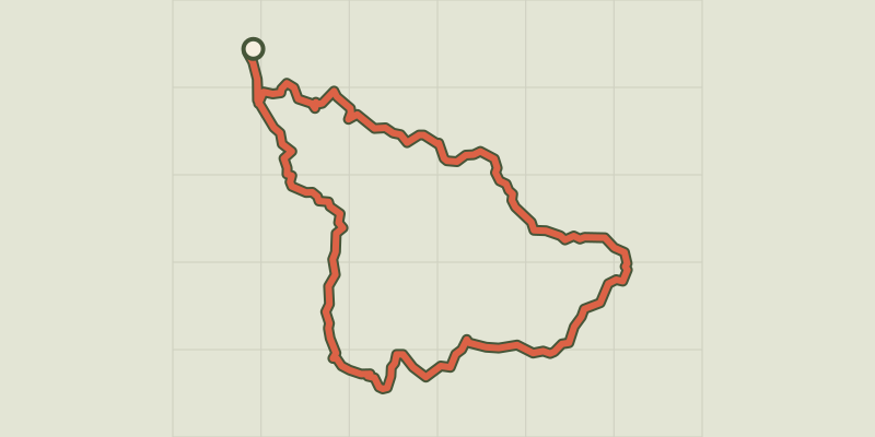
Key facts
- Distance
- 41.5 km
- Ascent
- +1,347 m
- Descent
- −1,003 m
- Estimated time
- 11 hr 20
- hiking
- Difficulty
- Moderate
- official rating
- Route
- Point to point
- ends elsewhere
Profile and gradient
- under 10%
- 10 to 20%
- over 20%
Gradient along the route: 36.5 km under 10% and 5.0 km at 10 to 20%. Elevation from 542 m to 1,026 m over 41.5 km.
Description
From Florac-Trois-Rivières, where the Cévennes National Park has its headquarters, enjoy a three-day immersion in the Cévennes, moving between schist valleys and small limestone plateaux with uninterrupted views of the Upper Cévennes. Starting in Florac, a town built at the confluence of three rivers, this route follows the Stevenson Trail upstream into the Mimente valley on the former railroad. It then joins Barre des Cévennes, a village strategically located on one of the most frequented passages between the lower and upper Cévennes, two different and complementary regions. To round off the hike, you cross the cans, small limestone plateaux, with dominant views onto the Tarnon valley and the edge of the Causse Méjean plateau. - Day 1: 18 km from Florac to the former train station at Cassagnas or 21 km from Florac to Cassagnas village, on the GR® 70 long-distance hiking path (waymarked white and red). - Day 2: 9 km from the former train station at Cassagnas to Barre des Cévennes or 12 km from Cassagnas village to Barre des Cévennes, on the GR® 72 (waymarked white and red). - Day 3: 15 km from Barre des Cévennes to Florac on the GR®7-67 / GR®43 (waymarked white and red). You first take the GR®7 and GR®67 to the Col des Faïsses pass, then the GR®43 to Florac.
Difficulty
Official rating: moderate, by Parc national des Cévennes.
Before you go
- Make sure your equipment is appropriate for the day’s weather conditions. Remember that the weather changes quickly in the mountains. Take enough water, wear sturdy shoes and put on a hat. Please close all gates and barriers behind you.
Getting there
Start: Florac, Florac Trois Rivières (48).
Sources
- Track: Parc national des Cévennes, Licence Ouverte 1.0, Licence Ouverte 1.0 (Etalab) (destination.cevennes-parcnational.fr/trek/43893-Les-hautes-Cevennes). Time estimated by GPX Path with the Mac app rule, breaks not included.
- Official elevation gain: 1,347 m, Parc national des Cévennes
Nearby tracks

 © OpenStreetMap, SRTM · OpenTopoMap (CC-BY-SA)
Florac: a spring in the town
Cévennes, Florac Trois Rivières (48) · LoopOfficial rating by Parc national des Cévennes © OpenStreetMap, SRTM · OpenTopoMap (CC-BY-SA)
Voie verte - Florac à Saint-Julien-d'Arpaon
Cévennes, Florac Trois Rivières (48) · Out and backOfficial rating by Parc national des Cévennes © OpenStreetMap, SRTM · OpenTopoMap (CC-BY-SA)
The clifftops
Cévennes, Florac Trois Rivières (48) · LoopOfficial rating by Parc national des Cévennes © OpenStreetMap, SRTM · OpenTopoMap (CC-BY-SA)
Gralhon
Cévennes, Florac Trois Rivières (48) · LoopOfficial rating by Parc national des Cévennes © OpenStreetMap, SRTM · OpenTopoMap (CC-BY-SA)
Variante courte des couronnes par Grimoald
Cévennes, Florac Trois Rivières (48) · LoopOfficial rating by Parc national des Cévennes © OpenStreetMap, SRTM · OpenTopoMap (CC-BY-SA)
Puecheral
Cévennes, Florac Trois Rivières (48) · LoopOfficial rating by Parc national des Cévennes