
The clifftops

Key facts
- Distance
- 14.2 km
- Ascent
- +854 m
- Descent
- −618 m
- Estimated time
- 4 hr 30
- hiking
- Difficulty
- Difficult
- official rating
- Route
- Loop
- back to the start
Profile and gradient
- under 10%
- 10 to 20%
- over 20%
Gradient along the route: 8.9 km under 10%, 4.6 km at 10 to 20% and 0.7 km over 20%. Elevation from 541 m to 1,032 m over 14.2 km.
Description
A unmissable trail starting from Florac, with a wealth of natural and heritage points of interest, and landscapes that are as varied as they are spectacular. This trail leads at the foot of the plateau of the Causse Méjean, which offers viewpoints towering over the valley of Florac and the spectacular “crowns”. On the horizon, the Cévennes and Mont Lozère stand out as a series of planes to infinity. Starting at the Maison du tourisme et du Parc (joint tourism office and National Park information centre) in Florac-Trois-Rivières, cross the RN 106 main road. Take the metal footbridge and keep straight ahead until you reach the Esplanade. Turn left and walk to the square. Take Rue du Quai and, at the crossroad, go straight ahead onto Rue de Remuret, which goes uphill to the Catholic church. Keep going uphill until you reach the D 16 road. - Turn left onto the road, and go past the council workshops and the entrance to Paul Arnal Park. After the bend, turn left. 200m later, the path rejoins the D 16. Cross the road and continue to climb straight ahead, crossing the road 4 times. - Below the ledge of the Causse plateau, head towards Mas Rouchet for 80 m. Then turn left onto the path leading to the dolmen on the edge of the Causse road. Turn left onto the road and follow it to the hairpin bend. - Follow the path that goes below the Causse ledge. For the first 400 m approximately, the path is steep and built with steps. Then it goes across the slope below the plateau ledge to the via ferrata at Le Rochefort. - Once on the flat area, ignore the path that goes up onto the Causse and go straight ahead on the path that hugs the slope, below the plateau ledge but above the cliffs. - At the crossing, take the path on the left that zigzags downhill amidst the cliffs to the hamlet of Croupillac. - Above the hamlet, the path veers left. At the far side of the meadow, turn left, go through the electric fence and follow the path that stays at mid-height on the side of the Causse. (NB: horse pasture, electric fence). The path crosses a track, goes downhill on the right, then goes through a meadow and rejoins the track.* - 80m later, you leave the track, turning onto a path on the right, which zigzags downhill towards the hamlet of Le Viala de Grimoald. At the path, turn right and, at the road, turn left, going uphill towards the houses. Once you have left the hamlet, turn right: the path joins up with the D 907. - Turn left to return to Florac. At the roundabout, go straight. As you reach the Collège (secondary school), fork left onto Rue du Pécher, then return to the Esplanade and the joint tourism office and National Park information centre.
Difficulty
Official rating: difficult, by Parc national des Cévennes.
Before you go
- Caution: steep climb, with a craggy and stepped first section below the clifftops. Some vertiginous sections. The descent to Croupillac is stony.
- Make sure your equipment is appropriate for the day's weather conditions. Remember that the weather changes quickly in the mountains. Take enough water, wear good shoes and put on a hat. Please close all gates and barriers after yourself.
Getting there
Start: Florac, Florac Trois Rivières (48).
Sources
- Track: Parc national des Cévennes, Licence Ouverte 1.0, Licence Ouverte 1.0 (Etalab) (destination.cevennes-parcnational.fr/trek/39399-Les-couronnes). Time estimated by GPX Path with the Mac app rule, breaks not included.
- Official elevation gain: 854 m, Parc national des Cévennes
Nearby tracks
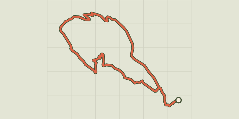
 © OpenStreetMap, SRTM · OpenTopoMap (CC-BY-SA)
Gralhon
Cévennes, Florac Trois Rivières (48) · LoopOfficial rating by Parc national des Cévennes © OpenStreetMap, SRTM · OpenTopoMap (CC-BY-SA)
Variante courte des couronnes par Grimoald
Cévennes, Florac Trois Rivières (48) · LoopOfficial rating by Parc national des Cévennes © OpenStreetMap, SRTM · OpenTopoMap (CC-BY-SA)
Voie verte - Florac à Saint-Julien-d'Arpaon
Cévennes, Florac Trois Rivières (48) · Out and backOfficial rating by Parc national des Cévennes © OpenStreetMap, SRTM · OpenTopoMap (CC-BY-SA)
Florac: a spring in the town
Cévennes, Florac Trois Rivières (48) · LoopOfficial rating by Parc national des Cévennes © OpenStreetMap, SRTM · OpenTopoMap (CC-BY-SA)
Discovering the Upper Cévennes
Cévennes, Florac Trois Rivières (48) · Point to pointOfficial rating by Parc national des Cévennes © OpenStreetMap, SRTM · OpenTopoMap (CC-BY-SA)
Puecheral
Cévennes, Florac Trois Rivières (48) · LoopOfficial rating by Parc national des Cévennes