
Gralhon
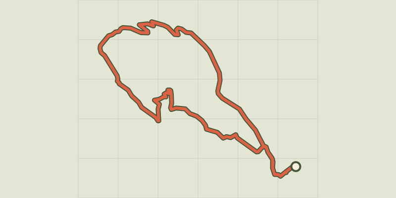
Key facts
- Distance
- 8.3 km
- Ascent
- +457 m
- Descent
- −335 m
- Estimated time
- 2 hr 35
- hiking
- Difficulty
- Easy
- official rating
- Route
- Loop
- back to the start
Profile and gradient
- under 10%
- 10 to 20%
- over 20%
Gradient along the route: 6.0 km under 10%, 2.1 km at 10 to 20% and 0.2 km over 20%. Elevation from 537 m to 810 m over 8.3 km.
Description
With panoramic views onto Florac and the Tarnon valley, this is a handsome trail amongst the chestnut trees that allows you to explore schist and limestone hamlets. This fairly short trail is ideal for those who are unsure about braving the tough ascent to the Causse plateau. It leads hikers under the cliffs, from where they have towering views over the small town of Florac nestling in the hollow of the narrow Tarnon valley, and then into the very heart of a chestnut grove. Starting at the joint tourism office and National Park information centre, cross the RN106 main road. Cross the metal bridge and go straight ahead until you reach the Esplanade. Turn right and then right again onto Rue du Thérond. Before the roundabout, turn left towards Lotissement "Les Grèzes". - At the second crossroads, in a big bend, go straight ahead and immediately take the path on the left going uphill towards a house. There, take the path on the right. - At Gralhon, follow the road for 400 m. - Leave the road to take a track on the right that runs along a flat ledge of the Causse Méjean, below the cliffs, to the hamlet of Monteils. - Go through the hamlet. - As you leave it, take on your right a path that goes downhill through the chestnut grove, cutting across the road. Cross an old bridge as you come out of the forest, then take the road to Salièges. - From here, follow the road downhill and along the river Tarn to Florac.
Difficulty
Official rating: easy, by Parc national des Cévennes.
Before you go
- Make sure your equipment is appropriate for the day's weather conditions. Remember that the weather changes quickly in the mountains. Take enough water, wear good shoes and put on a hat. Please close all gates and barriers after yourself.
Getting there
Start: Florac, Maison du Tourisme et du Parc national des Cévennes, Florac Trois Rivières (48).
Sources
- Track: Parc national des Cévennes, Licence Ouverte 1.0, Licence Ouverte 1.0 (Etalab) (destination.cevennes-parcnational.fr/trek/39410-Gralhon). Time estimated by GPX Path with the Mac app rule, breaks not included.
- Official elevation gain: 457 m, Parc national des Cévennes
Nearby tracks

 © OpenStreetMap, SRTM · OpenTopoMap (CC-BY-SA)
Variante courte des couronnes par Grimoald
Cévennes, Florac Trois Rivières (48) · LoopOfficial rating by Parc national des Cévennes © OpenStreetMap, SRTM · OpenTopoMap (CC-BY-SA)
The clifftops
Cévennes, Florac Trois Rivières (48) · LoopOfficial rating by Parc national des Cévennes © OpenStreetMap, SRTM · OpenTopoMap (CC-BY-SA)
Discovering the Upper Cévennes
Cévennes, Florac Trois Rivières (48) · Point to pointOfficial rating by Parc national des Cévennes © OpenStreetMap, SRTM · OpenTopoMap (CC-BY-SA)
Florac: a spring in the town
Cévennes, Florac Trois Rivières (48) · LoopOfficial rating by Parc national des Cévennes © OpenStreetMap, SRTM · OpenTopoMap (CC-BY-SA)
Voie verte - Florac à Saint-Julien-d'Arpaon
Cévennes, Florac Trois Rivières (48) · Out and backOfficial rating by Parc national des Cévennes © OpenStreetMap, SRTM · OpenTopoMap (CC-BY-SA)
Puecheral
Cévennes, Florac Trois Rivières (48) · LoopOfficial rating by Parc national des Cévennes