
La Condamine

Key facts
- Distance
- 7.2 km
- Ascent
- +181 m
- Descent
- −142 m
- Estimated time
- 1 hr 55
- hiking
- Difficulty
- Easy
- official rating
- Route
- Loop
- back to the start
Profile and gradient
- under 10%
- 10 to 20%
- over 20%
Gradient along the route: 6.8 km under 10% and 0.4 km at 10 to 20%. Elevation from 885 m to 1,020 m over 7.2 km.
Description
A sinkhole, lavogne (man-made-water hole) and dolmen are your signposts on this exploration of the agro-pastoral systems of yesteryear and today. A walk on the Causse Méjean, an arid plateau where locals have nevertheless succeeded in making a living. They did not settle here by chance, and had to adapt their rural way of living. Every element here has a story to tell. Can you guess what it might be ? From the crossroads, do not go towards La Condamine but instead take the path that crosses the vast farmed plain. Pass in between the ruins of Combe Lebrouze and the dolmen and continue straight on a path that heads into the small valley of Mativet. At the crossing, turn left onto the track that goes into the small valley and joins up with the road to Le Tomple. Turn left onto the road, go through the hamlet of Le Tomple, and take the track downhill towards a pass (col). NB: Not long before the pass, take the path on the left to the lavogne, then take the path above the lavogne to return to the lane leading to La Condamine. Turn left, pass in front of La Condamine and continue back to the car park.
Difficulty
Official rating: easy, by Parc national des Cévennes.
Before you go
- Make sure your equipment is appropriate for the day's weather conditions. Remember that the weather changes quickly in the mountains. Take enough water, wear good shoes and put on a hat. Close all gates and barriers after yourself. Please do not bring dogs (presence of livestock with guard dogs).
Getting there
Start: Croisement D68 et route de la Condamine, Gorges du Tarn Causses (48).
Sources
- Track: Parc national des Cévennes, Licence Ouverte 1.0, Licence Ouverte 1.0 (Etalab) (destination.cevennes-parcnational.fr/trek/40715-La-Condamine). Time estimated by GPX Path with the Mac app rule, breaks not included.
- Official elevation gain: 181 m, Parc national des Cévennes
Nearby tracks

 © OpenStreetMap, SRTM · OpenTopoMap (CC-BY-SA)
La Chadenède, The Monks
Cévennes, Gorges du Tarn Causses (48) · LoopOfficial rating by Parc national des Cévennes © OpenStreetMap, SRTM · OpenTopoMap (CC-BY-SA)
From Ispagnac to the mediaeval village of Sainte-Enimie.
Cévennes, Ispagnac (48) · Point to pointOfficial rating by Parc national des Cévennes © OpenStreetMap, SRTM · OpenTopoMap (CC-BY-SA)
Rocher des Fées
Cévennes, Ispagnac (48) · LoopOfficial rating by Parc national des Cévennes © OpenStreetMap, SRTM · OpenTopoMap (CC-BY-SA)
The two bridges
Cévennes, Ispagnac (48) · LoopOfficial rating by Parc national des Cévennes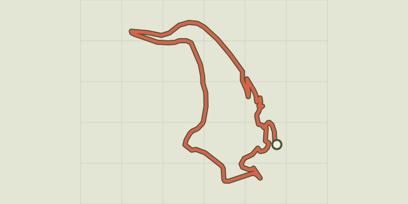 © OpenStreetMap, SRTM · OpenTopoMap (CC-BY-SA)
Castelbouc
Cévennes, Gorges du Tarn Causses (48) · LoopOfficial rating by Parc national des Cévennes © OpenStreetMap, SRTM · OpenTopoMap (CC-BY-SA)
Puecheral
Cévennes, Florac Trois Rivières (48) · LoopOfficial rating by Parc national des Cévennes