
Prunet
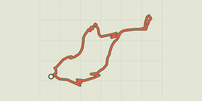
Key facts
- Distance
- 4.4 km
- Ascent
- +243 m
- Descent
- −198 m
- Estimated time
- 1 hr 25
- hiking
- Difficulty
- Easy
- official rating
- Route
- Loop
- back to the start
Profile and gradient
- under 10%
- 10 to 20%
- over 20%
Gradient along the route: 2.8 km under 10%, 1.3 km at 10 to 20% and 0.3 km over 20%. Elevation from 573 m to 766 m over 4.4 km.
Description
After an uphill section in a former chestnut grove, you have panoramic views over the Mimente valley, the Can de l’Hospitalet and the edge of the Causse Méjean with the Rocher de Roquefort cliffs towering over Florac. The walk starts from the car park at the town hall (mairie) in La Salle Prunet. Use the pedestrian crossing to cross the main road (N106), then go under the former railway bridge. Go up the concrete ramp and fork left. The path is briefly tarred and goes downhill for a few metres. Just after the stone house, the path goes uphill between houses on the right. The path comes out at the bottom of a field that you cross (50 m) to reach a larger path. Turn right onto this, towards La Valette. Continue on the main path through the chestnut grove and oak forest. At the crossing, continue straight ahead for the hamlet of La Valette, then return the way you came. Take the path that goes downhill on the left through the chestnut grove (electric fence, please close after yourself), then take the road on the right. After the hairpin bend, continue for 50 m to reach a path on the right, just above a house. Take the road to the last hairpin bend before the N106 main road, then turn right onto the old railway track to reach the village. Cross the bridge, continue for another 50 m and turn right to retrace your steps to the car park.
Difficulty
Official rating: easy, by Parc national des Cévennes.
Before you go
- Make sure your equipment is appropriate for the day's weather conditions. Remember that the weather changes quickly in the mountains. Take enough water, wear good shoes and put on a hat. Please close all gates and barriers after yourself.
Getting there
Start: Florac Trois Rivières (La Salle Prunet), Florac Trois Rivières (48).
Sources
- Track: Parc national des Cévennes, Licence Ouverte 1.0, Licence Ouverte 1.0 (Etalab) (destination.cevennes-parcnational.fr/trek/40185-Prunet). Time estimated by GPX Path with the Mac app rule, breaks not included.
- Official elevation gain: 243 m, Parc national des Cévennes
Nearby tracks

 © OpenStreetMap, SRTM · OpenTopoMap (CC-BY-SA)
Discovering the Upper Cévennes
Cévennes, Florac Trois Rivières (48) · Point to pointOfficial rating by Parc national des Cévennes © OpenStreetMap, SRTM · OpenTopoMap (CC-BY-SA)
Florac: a spring in the town
Cévennes, Florac Trois Rivières (48) · LoopOfficial rating by Parc national des Cévennes © OpenStreetMap, SRTM · OpenTopoMap (CC-BY-SA)
Variante courte des couronnes par Grimoald
Cévennes, Florac Trois Rivières (48) · LoopOfficial rating by Parc national des Cévennes © OpenStreetMap, SRTM · OpenTopoMap (CC-BY-SA)
Gralhon
Cévennes, Florac Trois Rivières (48) · LoopOfficial rating by Parc national des Cévennes © OpenStreetMap, SRTM · OpenTopoMap (CC-BY-SA)
Voie verte - Florac à Saint-Julien-d'Arpaon
Cévennes, Florac Trois Rivières (48) · Out and backOfficial rating by Parc national des Cévennes © OpenStreetMap, SRTM · OpenTopoMap (CC-BY-SA)
The clifftops
Cévennes, Florac Trois Rivières (48) · LoopOfficial rating by Parc national des Cévennes