
The Moulin de Bougès
Key facts
- Distance
- 9.1 km
- Ascent
- +497 m
- Descent
- −411 m
- Estimated time
- 2 hr 55
- hiking
- Difficulty
- Moderate
- official rating
- Route
- Loop
- back to the start
Profile and gradient
- under 10%
- 10 to 20%
- over 20%
Gradient along the route: 6.4 km under 10%, 1.1 km at 10 to 20% and 1.6 km over 20%. Elevation from 625 m to 976 m over 9.1 km.
Description
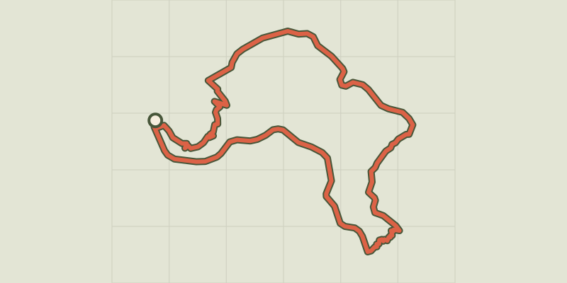
This is a journey back through time, past the ruins of the Château de Saint-Julien-d'Arpaon, the two menhirs lying nearby, and the disused railway track... After a beautiful climb onto the ridges of the Serre de Rébiouse, hikers are rewarded with a superb view onto the heather slopes of the Bougès massif. Then the path zigzags back downhill into the chestnut grove with its many clèdes (buildings for drying chestnuts) and terraced cropland. From the carpark below the temple (Protestant church), take the path uphill towards the temple, then follow the road to the top of the village. Take the path that runs alongside the Château and go uphill for about 700 m until you reach a lane. Cross it, fork left and go uphill through the heather to the highest point, which is on the western side. Follow the ridge eastwards to the Col de l'Agulharon. Then fork left. Take the lane to Bougès hamlet. As you leave the hamlet, take a downhill path, then a path on the left that runs across the slope, before returning downhill in many hairpin bends to the railway track. Turn right on this track to get back to Saint-Julien-d'Arpaon.
Difficulty
Official rating: moderate, by Parc national des Cévennes.
Before you go
- Make sure your equipment is appropriate for the day's weather conditions. Remember that the weather changes quickly in the mountains. Take enough water, wear good shoes and put on a hat. Please close all gates and barriers after yourself.
Getting there
Start: Saint-Julien-d'Arpaon, Cans et Cévennes (48).
Sources
- Track: Parc national des Cévennes, Licence Ouverte 1.0, Licence Ouverte 1.0 (Etalab) (destination.cevennes-parcnational.fr/trek/39251-Moulin-de-Bouges). Time estimated by GPX Path with the Mac app rule, breaks not included.
- Official elevation gain: 497 m, Parc national des Cévennes
Nearby tracks

 © OpenStreetMap, SRTM · OpenTopoMap (CC-BY-SA)
Prunet
Cévennes, Florac Trois Rivières (48) · LoopOfficial rating by Parc national des Cévennes © OpenStreetMap, SRTM · OpenTopoMap (CC-BY-SA)
Discovering the Upper Cévennes
Cévennes, Florac Trois Rivières (48) · Point to pointOfficial rating by Parc national des Cévennes © OpenStreetMap, SRTM · OpenTopoMap (CC-BY-SA)
Florac: a spring in the town
Cévennes, Florac Trois Rivières (48) · LoopOfficial rating by Parc national des Cévennes © OpenStreetMap, SRTM · OpenTopoMap (CC-BY-SA)
Voie verte - Florac à Saint-Julien-d'Arpaon
Cévennes, Florac Trois Rivières (48) · Out and backOfficial rating by Parc national des Cévennes © OpenStreetMap, SRTM · OpenTopoMap (CC-BY-SA)
Variante courte des couronnes par Grimoald
Cévennes, Florac Trois Rivières (48) · LoopOfficial rating by Parc national des Cévennes © OpenStreetMap, SRTM · OpenTopoMap (CC-BY-SA)
Gralhon
Cévennes, Florac Trois Rivières (48) · LoopOfficial rating by Parc national des Cévennes