
3-day Tour of the Emparis Plateau

Key facts
- Distance
- 25.6 km
- Ascent
- +1,537 m
- Descent
- −1,472 m
- Estimated time
- 9 hr 10
- hiking
- Difficulty
- Moderate
- official rating
- Route
- Point to point
- ends elsewhere
Profile and gradient
- under 10%
- 10 to 20%
- over 20%
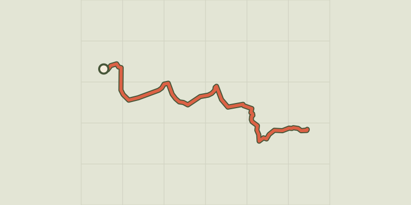
Gradient along the route: 14.5 km under 10%, 6.6 km at 10 to 20% and 4.5 km over 20%. Elevation from 1,193 m to 2,441 m over 25.6 km.
Description
During this 3-day circuit, you can see and admire in the distance the summits of Les Ecrins. A unique part of the mountain range, the Emparis plateau boasts one of the finest views you can enjoy in these mountains. La Meije, the Girose glacier, Le Râteau - names that are the stuff of dreams. But that's not all - such a great panorama is not enough. Mountain pastures, high-altitude villages and panoramas bring diversity to the journey. Welcome to the land between Isère and Hautes-Alpes. Here, high up in the mountains, the aroma of wild lavender mingles with the freshness of the glaciers. On the way up to the Emparis plateau, each glimpse adds its share of beauty. Below, Lake Chambon; above the majestic summits of Les Ecrins. Tradition, nature and high mountains come together to offer hikers an excursion that will delight both contemplative visitors and fans of mountain heritage. The first, fairly short stage invites hikers to stroll from villages to hamlets, to go up towards the schist paths around the mountains, and leads them to two areas where peace and quiet hold sway. First of all, Lake Lovitel with its discovery trail, then the hamlet of Les Clots, with, above, one of the most beautiful petrified waterfalls in Isère. On the 2nd day, you follow a magnificent path along the Pisse torrent, leading you above the waterfall of the same name and the famous petrified fountain. You soon arrive at the Fay and Mouterres refuges along a pastoral path. The path joins up with the GR54 before taking hikers upwards to a unique view over the Emparis plateau and its two landmark lakes: Lake Lerié and Lake Noir. Here the Ecrins glaciers and La Meije are revealed, in one of the finest views over the high mountain summits in the range. The 3rd stage, gently sloping downwards, goes through mountain pastures and leads through schist paths to Mizoën. We return to civilisation with a glimpse of the life of yesteryear in the ruins of Alpine chalets and farming terraces.
Difficulty
Official rating: moderate, by Parc national des Écrins.
Before you go
- Mountain biking is forbidden on the GR 50 due to the fragility of the natural environment (decree to protect the biotope).
- Camping, fires and water sports (including swimming) are prohibited on the Emparis plateau during the summer. Dogs must be kept on a lead. Bivouacs are permitted between 7pm and 9am.
Getting there
Start: Mizoen, Mizoën (38).
Sources
- Track: Parc national des Écrins, Licence Ouverte 2.0, Licence Ouverte 2.0 (Etalab) (destination.ecrins-parcnational.fr/trek/956786-Tour-du-plateau-d-Emparis-en-3-jours). Time estimated by GPX Path with the Mac app rule, breaks not included.
- Official elevation gain: 1,537 m, Parc national des Écrins
Nearby tracks
 © OpenStreetMap, SRTM · OpenTopoMap (CC-BY-SA)
Lovitel lake and the Clots refuge
Écrins, Mizoën (38) · Out and backOfficial rating by Parc national des Écrins © OpenStreetMap, SRTM · OpenTopoMap (CC-BY-SA)
4-day tour of the Plateau d'Emparis from Mizoën
Écrins, Mizoën (38) · Point to pointOfficial rating by Parc national des Écrins © OpenStreetMap, SRTM · OpenTopoMap (CC-BY-SA)
Les lacs du Plateau d’Emparis au départ de Besse
Écrins, Besse (38) · LoopOfficial rating by Parc national des Écrins © OpenStreetMap, SRTM · OpenTopoMap (CC-BY-SA)
Lake Quirlies
Écrins, Clavans-en-Haut-Oisans (38) · Out and backOfficial rating by Parc national des Écrins © OpenStreetMap, SRTM · OpenTopoMap (CC-BY-SA)
Muzelle Lake
Écrins, Les Deux Alpes (38) · Out and backOfficial rating by Parc national des Écrins © OpenStreetMap, SRTM · OpenTopoMap (CC-BY-SA)
Tour de l'Aiguille de Vénosc
Écrins, Les Deux Alpes (38) · Point to pointOfficial rating by Parc national des Écrins