
Col du Cheval de Bois
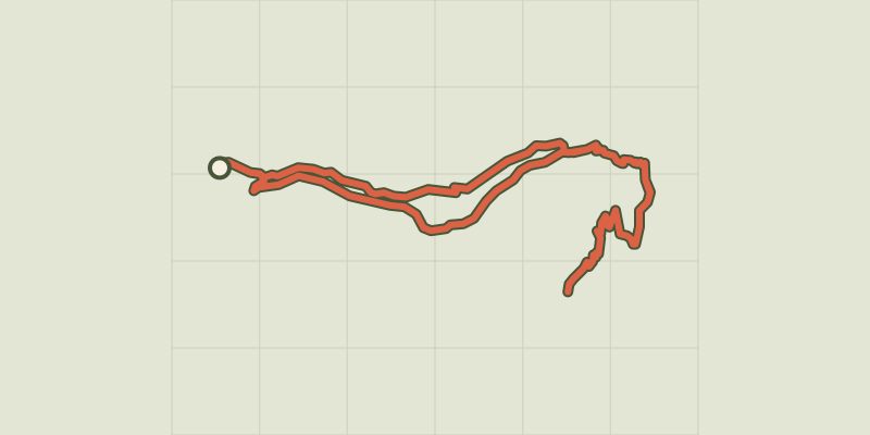
Key facts
- Distance
- 18.2 km
- Ascent
- +1,024 m
- Descent
- −993 m
- Estimated time
- 6 hr 15
- hiking
- Difficulty
- Difficult
- official rating
- Route
- Loop
- back to the start
Profile and gradient
- under 10%
- 10 to 20%
- over 20%
Gradient along the route: 9.1 km under 10% and 9.1 km at 10 to 20%. Elevation from 1,475 m to 2,476 m over 18.2 km.
Description
After making its way to the foot of the Sirac, the trail leads up to a col providing a magnificent view over the rare Champsaur glaciers. ”Col du Cheval de Bois is the meeting point of some major geological phenomena in the history of the Alps. I feel moved when I walk across what is actually the result of volcanic eruptions. Then, a little plant catches my attention, a plant that can only be found here at the summit of Mont Viso! What has happened? Nature is really very mysterious... " Rodolphe Papet, Champsaur park keeper and guide From the Auberts car park, walk up 200 m to the crossroads. Turn right to cross the Drac Blanc and go over to the left bank. The Pré de la Chaumette trail is signposted with arrows. On the path above the Prelles waterfall, three information panels mark the entrance of the protected centre of the National Park. Cross the footbridge over the Prelles torrent and continue on to the Pré de la Chaumette refuge. After crossing the Rougnoux torrent, make for Pas de la Cavale. Once you have crossed the footbridge, you arrive at a small plateau. At the fork, turn right and again cross the Rougnoux (this time across a ford). You then continue the path up to the col, where a wooden horse awaits you. For the return, follow the same route as far as the Pré de la Chaumette refuge, then take the path along the right bank of the torrent, around the south-facing slope and then follow the route you took on the way out all the way to the car park.
Difficulty
Official rating: difficult, by Parc national des Écrins.
Before you go
- In bad weather, take the same route back to the Pré de la Chaumette refuge along the left bank.
Getting there
Start: Les Auberts, Champoléon, Champoléon (05).
Sources
- Track: Parc national des Écrins, Licence Ouverte 2.0, Licence Ouverte 2.0 (Etalab) (destination.ecrins-parcnational.fr/trek/904195-Le-col-du-cheval-de-bois). Time estimated by GPX Path with the Mac app rule, breaks not included.
- Official elevation gain: 1,024 m, Parc national des Écrins
Nearby tracks

 © OpenStreetMap, SRTM · OpenTopoMap (CC-BY-SA)
De col en col jusqu'à Vallonpierre
Écrins, Champoléon (05) · Point to pointOfficial rating by Parc national des Écrins © OpenStreetMap, SRTM · OpenTopoMap (CC-BY-SA)
Crupillouse Lakes
Écrins, Champoléon (05) · Out and backOfficial rating by Parc national des Écrins © OpenStreetMap, SRTM · OpenTopoMap (CC-BY-SA)
Orcières Lakes
Écrins, Orcières (05) · LoopOfficial rating by Parc national des Écrins © OpenStreetMap, SRTM · OpenTopoMap (CC-BY-SA)
From the Drouvet summit to Prapic
Écrins, Orcières (05) · Point to pointOfficial rating by Parc national des Écrins © OpenStreetMap, SRTM · OpenTopoMap (CC-BY-SA)
Navette Valley
Écrins, La Chapelle-en-Valgaudémar (05) · LoopOfficial rating by Parc national des Écrins © OpenStreetMap, SRTM · OpenTopoMap (CC-BY-SA)
From Chabournéou to Vallonpierre on the Minister's footpath
Écrins, La Chapelle-en-Valgaudémar (05) · LoopOfficial rating by Parc national des Écrins