
The Arsine Lakes
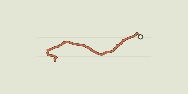
Key facts
- Distance
- 17.6 km
- Ascent
- +987 m
- Descent
- −955 m
- Estimated time
- 6 hr 05
- hiking
- Difficulty
- Difficult
- official rating
- Route
- Out and back
- same way back
Profile and gradient
- under 10%
- 10 to 20%
- over 20%
Gradient along the route: 10.6 km under 10%, 5.3 km at 10 to 20% and 1.8 km over 20%. Elevation from 1,512 m to 2,459 m over 17.6 km.
Description
The hamlet of Casset lives according to the changing colours, from the green prairies in the valley to the light blue of the Arsine glacial lakes. It is hard to imagine that just 60 years ago, the Arsine lakes did not exist and the entire site was covered by ice. Over time, plant life has colonised the new environment: purple saxifrage, creeping avens, campanula cenisia, genepi. There is even life in the cold water of the lakes. From the car park at the entrance of Casset, near the Park information centre, head up the hamlet by the main street and cross the second bridge over the Guisane, on the left. A straight track follows the Petit Tabuc stream and leads progressively from the hayfields into the woods. Beyond the barrier and the Clot du Gué bridge, a steady climb leads through the larch forest up to Grand Pré glade (1683 m), then on to the Douche lake (1901 m). The heart of the Ecrins National Park starts on the other side of the ford made of wood and stones. A winding footpath over a large area of scree gives well-deserved access to a mineral valley, populated with chamois. In the distance, on the right, the shepherd's mountain hut reminds us that the area is used for grazing. The footpath continues on the right of the valley and ends at the Arsine pass (2340 m). This is where you will leave the GR 54 to go over the frontal moraine of the Arsine glacier. From this ledge created by the movement of the glaciers, two large lakes mark the end of the route (2455 m). The Arsine glacial cirque is overlooked by majestic summits: you will marvel at Les Agneaux and the Neige Cordier Peak. Return by the same route.
Difficulty
Official rating: difficult, by Parc national des Écrins.
Getting there
Start: Le Casset (Le Mônetier-les-Bains), Le Monêtier-les-Bains (05).
Sources
- Track: Parc national des Écrins, Licence Ouverte 2.0, Licence Ouverte 2.0 (Etalab) (destination.ecrins-parcnational.fr/trek/903295-Les-lacs-d-Arsine-au-depart-du-Casset). Time estimated by GPX Path with the Mac app rule, breaks not included.
- Official elevation gain: 987 m, Parc national des Écrins
Nearby tracks

 © OpenStreetMap, SRTM · OpenTopoMap (CC-BY-SA)
From Le Casset to Le Lauzet
Écrins, Le Monêtier-les-Bains (05) · Out and backOfficial rating by Parc national des Écrins © OpenStreetMap, SRTM · OpenTopoMap (CC-BY-SA)
Lac de la Douche
Écrins, Le Monêtier-les-Bains (05) · Out and backOfficial rating by Parc national des Écrins © OpenStreetMap, SRTM · OpenTopoMap (CC-BY-SA)
Les Sagnières
Écrins, Le Monêtier-les-Bains (05) · LoopOfficial rating by Parc national des Écrins © OpenStreetMap, SRTM · OpenTopoMap (CC-BY-SA)
Tour entre Cerces et Ecrins (sans voiture)
Écrins, Le Monêtier-les-Bains (05) · LoopOfficial rating by Parc national des Écrins © OpenStreetMap, SRTM · OpenTopoMap (CC-BY-SA)
Combeynot Lake
Écrins, Le Monêtier-les-Bains (05) · Out and backOfficial rating by Parc national des Écrins © OpenStreetMap, SRTM · OpenTopoMap (CC-BY-SA)
Le Belvédère de l'homme
Écrins, Villar-d'Arêne (05) · Out and backOfficial rating by Parc national des Écrins