
The two farms of the Causse Noir

Key facts
- Distance
- 10.3 km
- Ascent
- +409 m
- Descent
- −338 m
- Estimated time
- 3 hr
- hiking
- Difficulty
- Moderate
- official rating
- Route
- Loop
- back to the start
Profile and gradient
- under 10%
- 10 to 20%
- over 20%
Gradient along the route: 8.0 km under 10% and 2.3 km at 10 to 20%. Elevation from 713 m to 1,041 m over 10.3 km.
Description
Explore the Causse Noir plateau between the Jonte valley and Mont Aigoual. From Jean-Séquier Square (in the village), take "chemin de la Vinade", a lane going uphill to the right of the Hôtel de l’Europe. 1) Then follow "Sérigas" on the GR® 62a hiking trail. The trail crosses the D39 twice. 2) In Sérigas, walk past the farm building, then turn left to reach the D39 once again. Turn right onto the road, walk for 200m and, having ignored two paths on the left, leave the road for a wide track on the left beyond a group of houses, towards "Le Marjoab". 3) Cross the hamlet of Le Marjoab and 150 m further on take the track on the left. 4) At the intersection of tracks, turn right towards "Meyrueis 4,6 km". NB! Take a path on the left that goes downhill and around a field to join up with the old Meyrueis-Le Vigan road in a bend. 5) Turn left onto it and walk downhill to Meyrueis. Cross the D 986 and enter the forest opposite. At the crossroads, turn left towards Meyrueis, join up with the road and turn left onto it. Then turn left onto Rue de l’Airette to return to Meyrueis.
Difficulty
Official rating: moderate, by Parc national des Cévennes.
Before you go
- Make sure your equipment is appropriate for the day’s weather conditions. Remember that the weather changes quickly in the mountains. Take enough water, wear sturdy shoes and put on a hat. Please close all gates and barriers behind you.
Getting there
Start: Meyrueis, parking Champs de Mars, Meyrueis (48).
Sources
- Track: Parc national des Cévennes, Licence Ouverte 1.0, Licence Ouverte 1.0 (Etalab) (destination.cevennes-parcnational.fr/trek/43960-Les-deux-fermes-du-causse-noir). Time estimated by GPX Path with the Mac app rule, breaks not included.
- Official elevation gain: 409 m, Parc national des Cévennes
Nearby tracks

 © OpenStreetMap, SRTM · OpenTopoMap (CC-BY-SA)
Roquedols Castle
Occitanie, Meyrueis (48) · LoopOfficial rating by Parc national des Cévennes © OpenStreetMap, SRTM · OpenTopoMap (CC-BY-SA)
Pauparelle
Cévennes, Meyrueis (48) · LoopOfficial rating by Parc national des Cévennes © OpenStreetMap, SRTM · OpenTopoMap (CC-BY-SA)
From Meyrueis to the summit of Mont Aigoual.
Cévennes, Meyrueis (48) · Point to pointOfficial rating by Parc national des Cévennes © OpenStreetMap, SRTM · OpenTopoMap (CC-BY-SA)
O Roquedols, my Roquedols!
Cévennes, Meyrueis (48) · LoopOfficial rating by Parc national des Cévennes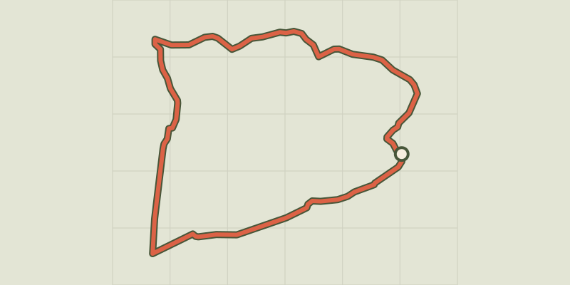 © OpenStreetMap, SRTM · OpenTopoMap (CC-BY-SA)
Dargilan
Occitanie, Meyrueis (48) · LoopOfficial rating by Parc national des Cévennes © OpenStreetMap, SRTM · OpenTopoMap (CC-BY-SA)
The streams walk
Cévennes, Meyrueis (48) · LoopOfficial rating by Parc national des Cévennes