
Les Baux de Provence - Chemin des Trémaïé
Key facts
- Distance
- 1.8 km
- Ascent
- +73 m
- Descent
- −52 m
- Estimated time
- 30 min
- hiking
- Difficulty
- Very easy
- official rating
- Route
- Loop
- back to the start
Profile and gradient
- under 10%
- 10 to 20%
- over 20%
Gradient along the route: 1.4 km under 10% and 0.4 km at 10 to 20%. Elevation from 141 m to 192 m over 1.8 km.
Description
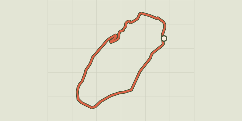
Come observe the birds which have left the hills to spend winter in these rocks, one of the best sights of France! In a beautiful setting at the foot of the rocky outcrop where the castle stands, take the time to stop and look, observe, and hear the birds sing at the break of dawn of a winter day. At the foot of the historic village of Les Baux-de-Provence, discover the history of Trémaïé and go up the steps leading to the village center to get to know this place, in the heart of the Alpilles, between the Baumayrane and Entreconque rocks. From the car park, take a left on the path that goes around the curve, below the castle. At the sign "Chapelle de Trémaïé", continue on the path to bypass the village of Les Baux-de-Provence. After the short descent, pass the Black Madonna of Baux-de-Provence. Then go up the stairs towards the village. 1 - When reaching the car park, turn right and climb the stairs. Once through the door of the ramparts and the last steps, continue straight and leave the ecomuseum on your left. At the next intersection, turn left. 2 - Once out of the village, turn right and climb the road. Go straight to reach the D27a and follow it until the car park from the starting point.
Difficulty
Official rating: very easy, by Parcs naturels régionaux de Provence-Alpes-Côte d'Azur.
Before you go
- You can go hiking during the winter season to watch the birds hibernate in the rocks.
- Come rather early in the morning (7.00 / 7am) or late afternoon (18.00 / 6pm) to enjoy the tranquillity of the area and to see and hear the birds sing.
- Toll car park.
Getting there
Start: Parking en bordure de la D27A, les Baux-de-Provence, Les Baux-de-Provence (13).
Sources
- Track: Parcs naturels régionaux de Provence-Alpes-Côte d'Azur (Chemins des Parcs), Licence Ouverte 2.0, Licence Ouverte 2.0 (Etalab) (www.cheminsdesparcs.fr/trek/43884-LES-BAUX-DE-PROVENCE---Chemin-des-Tremaie). Time estimated by GPX Path with the Mac app rule, breaks not included.
- Official elevation gain: 73 m, Parcs naturels régionaux de Provence-Alpes-Côte d'Azur
Nearby tracks

 © OpenStreetMap, SRTM · OpenTopoMap (CC-BY-SA)
Les Baux de Provence - Le Val d'Enfer
Provence-Alpes-Côte d'Azur, Les Baux-de-Provence (13) · LoopOfficial rating by Parcs naturels régionaux de Provence-Alpes-Côte d'Azur © OpenStreetMap, SRTM · OpenTopoMap (CC-BY-SA)
Les Baux de Provence - Autour de la bauxite
Provence-Alpes-Côte d'Azur, Les Baux-de-Provence (13) · LoopOfficial rating by Parcs naturels régionaux de Provence-Alpes-Côte d'Azur © OpenStreetMap, SRTM · OpenTopoMap (CC-BY-SA)
Les Baux de Provence - The Baumayrane ridges
Provence-Alpes-Côte d'Azur, Les Baux-de-Provence (13) · LoopOfficial rating by Parcs naturels régionaux de Provence-Alpes-Côte d'Azur © OpenStreetMap, SRTM · OpenTopoMap (CC-BY-SA)
Maussane les Alpilles - Over the water
Provence-Alpes-Côte d'Azur, Maussane-les-Alpilles (13) · LoopOfficial rating by Parcs naturels régionaux de Provence-Alpes-Côte d'Azur © OpenStreetMap, SRTM · OpenTopoMap (CC-BY-SA)
Maussane les Alpilles - Towards Les-Baux-de-Provence
Provence-Alpes-Côte d'Azur, Maussane-les-Alpilles (13) · LoopOfficial rating by Parcs naturels régionaux de Provence-Alpes-Côte d'Azur © OpenStreetMap, SRTM · OpenTopoMap (CC-BY-SA)
Le Paradou - Défends de Sousteyran
Provence-Alpes-Côte d'Azur, Paradou (13) · LoopOfficial rating by Parcs naturels régionaux de Provence-Alpes-Côte d'Azur