
Mouries - Caisses de Jean Jean

Key facts
- Distance
- 8.9 km
- Ascent
- +146 m
- Descent
- −119 m
- Estimated time
- 2 hr 15
- hiking
- Difficulty
- Easy
- official rating
- Route
- Loop
- back to the start
Profile and gradient
- under 10%
- 10 to 20%
- over 20%
Gradient along the route: 8.7 km under 10% and 0.2 km at 10 to 20%. Elevation from 30 m to 124 m over 8.9 km.
Description
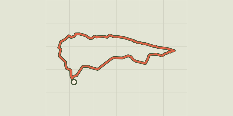
A legendary tour of the Alpilles, take the time to discover the famous Caisses de Jean-Jean. & Laquo; This loop is one of my favourite walks in the Alpilles. Here, we feel the presence of mankind through numerous imprints it has left. With greenhearts shaped by ivy on the picturesque cliffs and different landscapes, there is a very diversified fauna and flora. It is the kingdom of the European eagle-owl, but in winter a little remarkable climber also shows up regularly: , the Wallcreeper. & Raquo; Lisbeth Zechner, Project Manager LIFE Alpiller RNP. From the car park, continue on the road to the golf course of Servanes. At the entrance of the golf courses, continue on the road to go around it. At the crossroads with two paths, continue on the road until the next junction. 1 & Ndash; At the junction, follow the gravel path towards the car park for climbing "Les Caisses de Jean-Jean Nord". At 200m, pass the gate and continue until "Les Caisses de Jean-Jean". Continue on the footpath after the archaeological site. 2, At the viewpoint, take the small stony steep path leading down to the country road. Once on it, turn left and continue into the forest then along olive groves and a few constructions by man. Stay on the path until the paved road. 3, The road within sight, turn left and follow it until the next junction with the sign of the car park for climbing. The canal of the Baux valley, which first goes along the road, will make way for new olive groves which it supplies with water. 1, Continue straight on the road until the starting point and end the tour.
Difficulty
Official rating: easy, by Parcs naturels régionaux de Provence-Alpes-Côte d'Azur.
Before you go
- A booklet has been created and published by the association Chemin Faisan and the Alpilles Regional Nature Park. Don't forget to get it to discover the Caisses de Jean-Jean in a fun way!
- Come rather early in the morning (7.00) or late afternoon (18.00) to enjoy the tranquillity of the area and to see and hear the birds sing.
- Bring a pair of binoculars.
Getting there
Start: Parking du Castellas, Mouriès, Mouriès (13).
Sources
- Track: Parcs naturels régionaux de Provence-Alpes-Côte d'Azur (Chemins des Parcs), Licence Ouverte 2.0, Licence Ouverte 2.0 (Etalab) (www.cheminsdesparcs.fr/trek/40041-MOURIES---Les-Caisses-de-Jean-Jean). Time estimated by GPX Path with the Mac app rule, breaks not included.
- Official elevation gain: 146 m, Parcs naturels régionaux de Provence-Alpes-Côte d'Azur
Nearby tracks
 © OpenStreetMap, SRTM · OpenTopoMap (CC-BY-SA)
At the heart of an olive grove
Provence-Alpes-Côte d'Azur, Mouriès (13) · LoopOfficial rating by Parcs naturels régionaux de Provence-Alpes-Côte d'Azur © OpenStreetMap, SRTM · OpenTopoMap (CC-BY-SA)
Saint Martin de Crau - Circuit of Garrigue
Provence-Alpes-Côte d'Azur, Saint-Martin-de-Crau (13) · LoopOfficial rating by Parcs naturels régionaux de Provence-Alpes-Côte d'Azur © OpenStreetMap, SRTM · OpenTopoMap (CC-BY-SA)
Maussane les Alpilles - Towards Les-Baux-de-Provence
Provence-Alpes-Côte d'Azur, Maussane-les-Alpilles (13) · LoopOfficial rating by Parcs naturels régionaux de Provence-Alpes-Côte d'Azur © OpenStreetMap, SRTM · OpenTopoMap (CC-BY-SA)
Maussane les Alpilles - Over the water
Provence-Alpes-Côte d'Azur, Maussane-les-Alpilles (13) · LoopOfficial rating by Parcs naturels régionaux de Provence-Alpes-Côte d'Azur © OpenStreetMap, SRTM · OpenTopoMap (CC-BY-SA)
Le Paradou - The Castillon Towers
Provence-Alpes-Côte d'Azur, Paradou (13) · LoopOfficial rating by Parcs naturels régionaux de Provence-Alpes-Côte d'Azur © OpenStreetMap, SRTM · OpenTopoMap (CC-BY-SA)
La Vallongue
Provence-Alpes-Côte d'Azur, Aureille (13) · LoopOfficial rating by Parcs naturels régionaux de Provence-Alpes-Côte d'Azur