
Saint Martin de Crau - Circuit of Garrigue

Key facts
- Distance
- 4.0 km
- Ascent
- +43 m
- Descent
- −26 m
- Estimated time
- 55 min
- hiking
- Difficulty
- Very easy
- official rating
- Route
- Loop
- back to the start
Profile and gradient
- under 10%
- 10 to 20%
- over 20%
Gradient along the route: 4.0 km under 10%. Elevation from 31 m to 66 m over 4.0 km.
Description
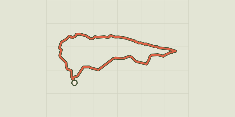
Discover the scrubland by browsing the towns of Saint-Martin-de-Crau and Mouriès, with a magnificent view of the Alpilles. After browsing a wild scrubland and closed, take the time to stroll along olive groves punctuated with a more open scrubland. This circuit will bring you to the meeting of a rich biodiversity, where the passionate birds and insects will then have the pleasure to discover them according to the landscapes. From the parking, pass the barrier and take the right path bordered scrubland (yellow PR marking). Continue for 600 m. 1- Make a left turn then another right. Enter an area where vegetation is less dense. Continue to follow the main path (yellow PR signage) going north on 400 m. 2- Make a left turn while continuing on the main path (yellow PR marking). After 400 m, go down through the olive trees to join the Draille de l'Anellier. 3- Take this draille on the right. Continue straight for 1.5 km until you reach the intersection with the D5. Switch to the right on the latter (stay on the yellow shoulders provided to this effect). Continue 300 m and join the departure car park.
Difficulty
Official rating: very easy, by Parcs naturels régionaux de Provence-Alpes-Côte d'Azur.
Before you go
- For your safety, and for the preservation of forest areas, access to natural areas is regulated from June to September. Inquire during the summer period on 08 11 20 13 13 (price of a local call) or on www.bouches-du-rhone.pref.gouv.fr Download the application for free MYPROVENCE ENVIE DE BALADE (available on Appstore and Android Market).
Getting there
Start: Parking Mas de Payan, Saint-Martin-de-Crau, Saint-Martin-de-Crau (13).
Sources
- Track: Parcs naturels régionaux de Provence-Alpes-Côte d'Azur (Chemins des Parcs), Licence Ouverte 2.0, Licence Ouverte 2.0 (Etalab) (www.cheminsdesparcs.fr/trek/58945-SAINT-MARTIN-DE-CRAU---Circuit-de-la-Garrigue). Time estimated by GPX Path with the Mac app rule, breaks not included.
- Official elevation gain: 43 m, Parcs naturels régionaux de Provence-Alpes-Côte d'Azur
Nearby tracks
 © OpenStreetMap, SRTM · OpenTopoMap (CC-BY-SA)
At the heart of an olive grove
Provence-Alpes-Côte d'Azur, Mouriès (13) · LoopOfficial rating by Parcs naturels régionaux de Provence-Alpes-Côte d'Azur © OpenStreetMap, SRTM · OpenTopoMap (CC-BY-SA)
Mouries - Caisses de Jean Jean
Provence-Alpes-Côte d'Azur, Mouriès (13) · LoopOfficial rating by Parcs naturels régionaux de Provence-Alpes-Côte d'Azur © OpenStreetMap, SRTM · OpenTopoMap (CC-BY-SA)
La Vallongue
Provence-Alpes-Côte d'Azur, Aureille (13) · LoopOfficial rating by Parcs naturels régionaux de Provence-Alpes-Côte d'Azur © OpenStreetMap, SRTM · OpenTopoMap (CC-BY-SA)
A Mediterranean bird festival
Provence-Alpes-Côte d'Azur, Aureille (13) · Out and backOfficial rating by Parcs naturels régionaux de Provence-Alpes-Côte d'Azur © OpenStreetMap, SRTM · OpenTopoMap (CC-BY-SA)
Maussane les Alpilles - Towards Les-Baux-de-Provence
Provence-Alpes-Côte d'Azur, Maussane-les-Alpilles (13) · LoopOfficial rating by Parcs naturels régionaux de Provence-Alpes-Côte d'Azur © OpenStreetMap, SRTM · OpenTopoMap (CC-BY-SA)
Maussane les Alpilles - Over the water
Provence-Alpes-Côte d'Azur, Maussane-les-Alpilles (13) · LoopOfficial rating by Parcs naturels régionaux de Provence-Alpes-Côte d'Azur