
the Sauze balconies
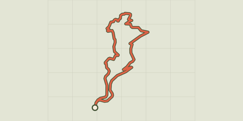
Key facts
- Distance
- 6.4 km
- Ascent
- +251 m
- Descent
- −248 m
- Estimated time
- 55 min
- mtb
- Difficulty
- Easy
- official rating
- Route
- Loop
- back to the start
Profile and gradient
- under 10%
- 10 to 20%
- over 20%
Gradient along the route: 4.6 km under 10% and 1.8 km at 10 to 20%. Elevation from 794 m to 1,044 m over 6.4 km.
Description
A dynamic and sporty course, despite its short distance, offering superb panoramas of the lake. This itinerary will immerse you into the lakeside setting from the village perched above. The course is wooded, but the water sparkles through the pines and downy oaks. The vegetation, which becomes increasingly dense as we descend, lends a special charm to this route, which winds its way through isolated valleys on narrow paths that seem to spring up from nowhere in front of us. The return journey takes several hairpins and gives the impression of climbing a small pass, the summit of which is still hidden from us. - From the La Fontaine car park, head back down the departmental road towards Savines-le-Lac for a few dozen metres, then take the path to the left of the cross. Turn left at a picnic area and continue straight ahead through the woods. Turn left when the view of the lake opens up, onto a narrow, steep and winding path. Follow this path until you come to a wide track. Turn left then left again into a very shady valley after a stream. Leave the path and take a path on the right back into the pines. Turn left and then right into the woods. Turn right again when you come back to a wide, steeply sloping path, then veer left and finally right onto a road. - Follow the winding road to the departmental road. The gradient is moderate but the climb is still relatively long. Finally, turn right onto the departmental road to return to Le Sauze-du-Lac.
Difficulty
Official rating: easy, by Parc national des Écrins.
Getting there
Start: Le Sauze-du-Lac, Le Sauze-du-Lac (05).
Sources
- Track: Parc national des Écrins, Licence Ouverte 2.0, Licence Ouverte 2.0 (Etalab) (destination.ecrins-parcnational.fr/trek/987875-N28---Les-balcons-du-Sauze). Time estimated by GPX Path with the Mac app rule, breaks not included.
- Official elevation gain: 251 m, Parc national des Écrins
Nearby tracks

 © OpenStreetMap, SRTM · OpenTopoMap (CC-BY-SA)
Le Fein
Provence-Alpes-Côte d'Azur, Chorges (05) · LoopOfficial rating by Parc national des Écrins © OpenStreetMap, SRTM · OpenTopoMap (CC-BY-SA)
De Chorges à la Baie Saint-Michel en VTT ou Gravel
Provence-Alpes-Côte d'Azur, Chorges (05) · Point to pointOfficial rating by Parc national des Écrins © OpenStreetMap, SRTM · OpenTopoMap (CC-BY-SA)
Serre Renard
Provence-Alpes-Côte d'Azur, Chorges (05) · LoopOfficial rating by Parc national des Écrins © OpenStreetMap, SRTM · OpenTopoMap (CC-BY-SA)
Chanteloube mountain bike loop
Provence-Alpes-Côte d'Azur, Chorges (05) · LoopOfficial rating by Parc national des Écrins © OpenStreetMap, SRTM · OpenTopoMap (CC-BY-SA)
La Maniane
Écrins, Savines-le-Lac (05) · LoopOfficial rating by Parc national des Écrins © OpenStreetMap, SRTM · OpenTopoMap (CC-BY-SA)
Serre-Verger circuit
Écrins, Savines-le-Lac (05) · LoopOfficial rating by Parc national des Écrins