
Roc de La Truque
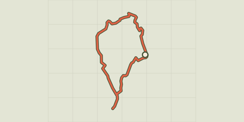
Key facts
- Distance
- 10.1 km
- Ascent
- +245 m
- Descent
- −208 m
- Estimated time
- 2 hr 40
- hiking
- Difficulty
- Easy
- official rating
- Route
- Loop
- back to the start
Profile and gradient
- under 10%
- 10 to 20%
- over 20%
Gradient along the route: 9.6 km under 10% and 0.5 km at 10 to 20%. Elevation from 800 m to 935 m over 10.1 km.
Description
Discover a rural world perched between tradition and modernity, between old buildings and modern constructions. Take a journey from yesterday to today on this path, which is entirely located on the plateau. By the bread oven, take the track between the farm buildings and hangars uphill to the pass. 1) Take the track on the right to reach the hamlet of Mazel-Bouissy. 2) In the hamlet, go up the lane on the left just after a stone cross to join a wider track. Turn left and then right. Go uphill to the intersection. 3) At the intersection, turn left and, at the top of the slope, continue on the right to the hamlet of Les Cayroux. 4) Take the road on your right for 60 m, then turn left and take the path for 1.1 km to a crossroads (Terres rouges), from which a detour to the Clapas de la Truque is possible (then retrace your steps). 5) At the crossroads, turn left, a detour to the Clapas de la Truque is possible (then retrace your steps); at the second crossroads turn left again. Continue on the draille (drovers’ road) to go up towards Cauquenas. 6) Before the hamlet, turn right, go through the hamlet and, at the road, turn left to return to the car park.
Difficulty
Official rating: easy, by Parc national des Cévennes.
Before you go
- This walk has little shade. Make sure your equipment is appropriate for the day’s weather conditions. Remember that the weather changes quickly in the mountains. Take enough water, wear sturdy shoes and put on a hat. Please close all gates and barriers behind you.
Getting there
Start: Cauquenas, La Malène (48).
Sources
- Track: Parc national des Cévennes, Licence Ouverte 1.0, Licence Ouverte 1.0 (Etalab) (destination.cevennes-parcnational.fr/trek/44016-Roc-de-la-Truque). Time estimated by GPX Path with the Mac app rule, breaks not included.
- Official elevation gain: 245 m, Parc national des Cévennes
Nearby tracks

 © OpenStreetMap, SRTM · OpenTopoMap (CC-BY-SA)
Roc des Hourtous
Cévennes, La Malène (48) · LoopOfficial rating by Parc national des Cévennes © OpenStreetMap, SRTM · OpenTopoMap (CC-BY-SA)
Birds of the Causses and Gorges
Cévennes, La Malène (48) · LoopOfficial rating by Parc national des Cévennes © OpenStreetMap, SRTM · OpenTopoMap (CC-BY-SA)
cirque de Saint-Chély-du-Tarn
Cévennes, Gorges du Tarn Causses (48) · LoopOfficial rating by Parc national des Cévennes © OpenStreetMap, SRTM · OpenTopoMap (CC-BY-SA)
Puech d'Alluech
Cévennes, Mas-Saint-Chély (48) · LoopOfficial rating by Parc national des Cévennes © OpenStreetMap, SRTM · OpenTopoMap (CC-BY-SA)
Baousse del Biel
Cévennes, Massegros Causses Gorges (48) · LoopOfficial rating by Parc national des Cévennes © OpenStreetMap, SRTM · OpenTopoMap (CC-BY-SA)
The riverbanks
Cévennes, Gorges du Tarn Causses (48) · LoopOfficial rating by Parc national des Cévennes