
Ruas

Key facts
- Distance
- 5.9 km
- Ascent
- +368 m
- Descent
- −338 m
- Estimated time
- 2 hr 05
- hiking
- Difficulty
- Moderate
- official rating
- Route
- Loop
- back to the start
Profile and gradient
- under 10%
- 10 to 20%
- over 20%
Gradient along the route: 2.8 km under 10%, 2.2 km at 10 to 20% and 0.9 km over 20%. Elevation from 707 m to 1,035 m over 5.9 km.
Description
Incredible views over the valleys between Bédouès and the foothills of Mont Lozère, you will never tire of them ! From up here, you can make out the waterfall at Runes, Miral Castle, the hillocks of Les Bondons, standing stones, the Lozerette waterfall and, on the opposite slope, the hamlets of Le Cros and Les Bondons. Take the road downhill and, at the first crossroads, turn right onto the road that goes uphill to Chabrières. - In Chabrières follow the track uphill to the reservoir to the foot of the hillock. - Walk around Le Puech on the left and, by the water trough, veer slightly left to cross the field and reach the stile, which you use to get over the fence. - Turn right onto the track for 1 km. At the junction, turn right and immediately go right to reach the plateau edge. - To the left of the rock, take a small path on the left downhill to the village of Ruas. - By the iron cross, the old path has become too overgrown; walk just below it to a ravine. By the stone cross, follow the path that runs alongside the brook on the left to reach the village. - At the road, turn right to return to the starting-point.
Difficulty
Official rating: moderate, by Parc national des Cévennes.
Before you go
- Steep up hill and downhill sections; path without shade. Make sure your equipment is appropriate for the day’s weather conditions. Remember that the weather changes quickly in the mountains. Take enough water, wear sturdy shoes and put on a hat. Please close all gates and barriers behind you.
Getting there
Start: Parking entre Ruas et l’embranchement de Chabrières, Les Bondons (48).
Sources
- Track: Parc national des Cévennes, Licence Ouverte 1.0, Licence Ouverte 1.0 (Etalab) (destination.cevennes-parcnational.fr/trek/73281-Ruas). Time estimated by GPX Path with the Mac app rule, breaks not included.
- Official elevation gain: 368 m, Parc national des Cévennes
Nearby tracks

 © OpenStreetMap, SRTM · OpenTopoMap (CC-BY-SA)
Puecheral
Cévennes, Florac Trois Rivières (48) · LoopOfficial rating by Parc national des Cévennes © OpenStreetMap, SRTM · OpenTopoMap (CC-BY-SA)
Voie verte - Florac à Saint-Julien-d'Arpaon
Cévennes, Florac Trois Rivières (48) · Out and backOfficial rating by Parc national des Cévennes © OpenStreetMap, SRTM · OpenTopoMap (CC-BY-SA)
Florac: a spring in the town
Cévennes, Florac Trois Rivières (48) · LoopOfficial rating by Parc national des Cévennes © OpenStreetMap, SRTM · OpenTopoMap (CC-BY-SA)
Discovering the Upper Cévennes
Cévennes, Florac Trois Rivières (48) · Point to pointOfficial rating by Parc national des Cévennes © OpenStreetMap, SRTM · OpenTopoMap (CC-BY-SA)
The clifftops
Cévennes, Florac Trois Rivières (48) · LoopOfficial rating by Parc national des Cévennes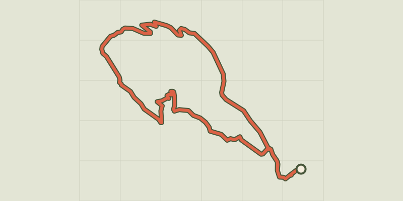 © OpenStreetMap, SRTM · OpenTopoMap (CC-BY-SA)
Gralhon
Cévennes, Florac Trois Rivières (48) · LoopOfficial rating by Parc national des Cévennes