
Chargès Valley

Key facts
- Distance
- 18.7 km
- Ascent
- +1,283 m
- Descent
- −1,215 m
- Estimated time
- 7 hr 20
- hiking
- Difficulty
- Difficult
- official rating
- Route
- Out and back
- same way back
Profile and gradient
- under 10%
- 10 to 20%
- over 20%
Gradient along the route: 7.0 km under 10%, 8.9 km at 10 to 20% and 2.8 km over 20%. Elevation from 1,472 m to 2,680 m over 18.7 km.
Description
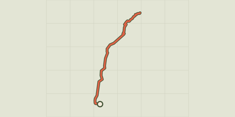
In the Spring, the flowery valley is adorned with many different colours. It leads to the Règue mountain pass which signifies « flock » in Patois. The green colour of the bottom of the slopes contrasts with the uppermost grey-brown summits. The freshness of the grass accentuates the austerity of the rock which is sometimes sprinkled with snow. As for the torrent, it animates the hollow of the valley where it not rare to meet a cow coming there to drink. From Gourniers car park, cross the hamlet and follow the track until la Chapelle-Saint-Marcellin. The track follows the hillside until a walkway at (Pont la Claie) then goes up to the cabin at Pré d'Antoni. Follow along to a torrent (walkway). Climb a grassy slope to reach a lower shelf and the source of the Chargès. From the source, follow « the drailles » (local word signifying ‘paths’ created by the passage of sheep) and cross a little stream running from a waterfall. The path meanders towards the mountain pass, marked with red lozenges and cairns.
Difficulty
Official rating: difficult, by Parc national des Écrins.
Before you go
- Between la Chapelle-Saint-Marcellin and Claie bridge, there is a danger of falling rocks, particularly during heavy rain. At that time the itinerary is not advisable. At the end of the track, that crosses the pasture, it is not very visible. Follow the cairns. Be careful when faced with pockets of snow remaining at the bottom of the mountain pass.
Getting there
Start: Les Gourniers, Réallon, Réallon (05).
Sources
- Track: Parc national des Écrins, Licence Ouverte 2.0, Licence Ouverte 2.0 (Etalab) (destination.ecrins-parcnational.fr/trek/904074-Col-de-la-Regue-par-le-vallon-de-Charges). Time estimated by GPX Path with the Mac app rule, breaks not included.
- Official elevation gain: 1,283 m, Parc national des Écrins
Nearby tracks
 © OpenStreetMap, SRTM · OpenTopoMap (CC-BY-SA)
The chapel at Saint-Marcellin
Écrins, Réallon (05) · Out and backOfficial rating by Parc national des Écrins © OpenStreetMap, SRTM · OpenTopoMap (CC-BY-SA)
The Chargès source
Écrins, Réallon (05) · Out and backOfficial rating by Parc national des Écrins © OpenStreetMap, SRTM · OpenTopoMap (CC-BY-SA)
Oussella loop
Écrins, Réallon (05) · LoopOfficial rating by Parc national des Écrins © OpenStreetMap, SRTM · OpenTopoMap (CC-BY-SA)
Le Pré d'Antoni cabin
Écrins, Réallon (05) · Out and backOfficial rating by Parc national des Écrins © OpenStreetMap, SRTM · OpenTopoMap (CC-BY-SA)
Les Gourniers discovery path
Écrins, Réallon (05) · LoopOfficial rating by Parc national des Écrins © OpenStreetMap, SRTM · OpenTopoMap (CC-BY-SA)
Balcon de l'Oussella and Quille du Laus
Écrins, Réallon (05) · LoopOfficial rating by Parc national des Écrins