
From Villar-Loubière to La-Chapelle-en-Valgaudemar

Key facts
- Distance
- 14.6 km
- Ascent
- +1,405 m
- Descent
- −1,348 m
- Estimated time
- 7 hr 25
- hiking
- Difficulty
- Difficult
- official rating
- Route
- Point to point
- ends elsewhere
Profile and gradient
- under 10%
- 10 to 20%
- over 20%
Gradient along the route: 2.2 km under 10%, 5.5 km at 10 to 20% and 6.9 km over 20%. Elevation from 1,086 m to 2,408 m over 14.6 km.
Description
An itinerary that offers stunning views of the Valgaudemar valley. Ideal for those who like steep hiking. The climb to the Souffles mountain refuge is made by a footpath worthy of an alpine garden with its flowers and butterflies. If you are lucky, you will hear the black grouse before you arrive at the refuge, where you will be able to watch vultures flying above the Lautier lake. In any case, you have every chance of seeing a chamois on your way to the Colombe pass. From the Villard Loubière car park, head up to the village by following the signs for Souffles mountain refuge on the GR54. The footpath progresses through the shingle and moors and into a narrow valley. As you get closer to the refuge, beech trees appear, then larch trees line the way up to the Souffles mountain refuge that is at an altitude of 1968 m. Leave the GR route and take the footpath behind the refuge towards the Lautier lake. Crossing the Clochettes pass will lead you to the Lautier valley. Do not take the path that goes down into the valley but continue towards the lake, which will soon be visible. Then head to the nearby Colombes pass, which is at an altitude of 2427 m (from where it is possible head off up to the Turbat Peak, 3028 m, by an off-trail itinerary). Start the long descent towards La Chapelle en Valgaudemar. Leave the path on the left that goes to the Pas de l'Olan and the refuge of the same name, and continue the descent via Le Clot until you reach La Chapelle en Valgaudemar at an altitude of 1100 m.
Difficulty
Official rating: difficult, by Parc national des Écrins.
Before you go
- If you are driving, you will need to organise a shuttle, leaving a vehicle at the starting point, which is the Olan refuge car park just after the village of La Chapelle en Valgaudemar. You can also use the Conseil Général's shuttle service. For information call 04 92 502 505.
Getting there
Start: Parking de Villar-Loubière, Villar-Loubière (05).
Sources
- Track: Parc national des Écrins, Licence Ouverte 2.0, Licence Ouverte 2.0 (Etalab) (destination.ecrins-parcnational.fr/trek/903501-De-Villar-Loubiere-a-La-Chapelle-en-Valgaudemar). Time estimated by GPX Path with the Mac app rule, breaks not included.
- Official elevation gain: 1,405 m, Parc national des Écrins
Nearby tracks

 © OpenStreetMap, SRTM · OpenTopoMap (CC-BY-SA)
Valgaudemar refuges
Écrins, Villar-Loubière (05) · Point to pointOfficial rating by Parc national des Écrins © OpenStreetMap, SRTM · OpenTopoMap (CC-BY-SA)
Village of Les Peines
Écrins, Villar-Loubière (05) · LoopOfficial rating by Parc national des Écrins © OpenStreetMap, SRTM · OpenTopoMap (CC-BY-SA)
Du refuge des Souffles au refuge de l'Olan (sans voiture)
Écrins, Villar-Loubière (05) · Point to pointOfficial rating by Parc national des Écrins © OpenStreetMap, SRTM · OpenTopoMap (CC-BY-SA)
Pétarel Lakes by the Andrieux
Écrins, La Chapelle-en-Valgaudémar (05) · Out and backOfficial rating by Parc national des Écrins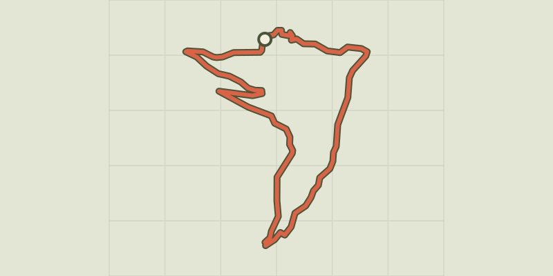 © OpenStreetMap, SRTM · OpenTopoMap (CC-BY-SA)
Les Oulles du Diable
Écrins, La Chapelle-en-Valgaudémar (05) · LoopOfficial rating by Parc national des Écrins © OpenStreetMap, SRTM · OpenTopoMap (CC-BY-SA)
The Pétarel Lakes via Les Portes
Écrins, La Chapelle-en-Valgaudémar (05) · Out and backOfficial rating by Parc national des Écrins