
The climb at Dormillouse
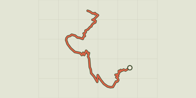
Key facts
- Distance
- 4.3 km
- Ascent
- +332 m
- Descent
- −328 m
- Estimated time
- 1 hr 55
- hiking
- Difficulty
- Very easy
- official rating
- Route
- Out and back
- same way back
Profile and gradient
- under 10%
- 10 to 20%
- over 20%
Gradient along the route: 1.1 km under 10%, 2.4 km at 10 to 20% and 0.9 km over 20%. Elevation from 1,442 m to 1,771 m over 4.3 km.
Description
An inhabited village at the heart of the Ecrins National Park which discloses its architecture and its history throughout its "quartiers"or hamlets. Village perched up on the ice cap, Dormillouse overhangs the impetuous waterfall. Its isolation enabled the Vaudois, the « damned by God » in the Middle Ages, to take refuge from persectution. Still today, you can only discover this village full of history on foot.. Park at the Cascades carpark, at the terminus of the road, right at the bottom of Freissinières valley. - Take the path to the left where you will find the entrance to the National Park, three explanatory signs (leave to the right by the walkway which leads to the winter path). Follow the itinerary « Dormillouse ». Take the bridge over the Oules torrent and continue along the bending path that leads beside the big waterfall then cross an area of rocky scree. - At the following crossroads, leave the path on the left (Fangeas lake, Terres Blanches mountain path) and keep to the right which leads to the prairies, take the righthand walkway which leads to Dormillouse village. - Come back to the Cascades carpark by the same itinerary.
Difficulty
Official rating: very easy, by Parc national des Écrins.
Before you go
- The path accessing Dormillouse can only be used in Summer. Remember: camping is forbidden including in and near the carpark.
Getting there
Start: Les cascades, Dormillouse, Freissinières, Freissinières (05).
Sources
- Track: Parc national des Écrins, Licence Ouverte 2.0, Licence Ouverte 2.0 (Etalab) (destination.ecrins-parcnational.fr/trek/905618-La-montee-a-Dormillouse). Time estimated by GPX Path with the Mac app rule, breaks not included.
- Official elevation gain: 332 m, Parc national des Écrins
Nearby tracks

 © OpenStreetMap, SRTM · OpenTopoMap (CC-BY-SA)
The Dormillouse circuit
Écrins, Freissinières (05) · LoopOfficial rating by Parc national des Écrins © OpenStreetMap, SRTM · OpenTopoMap (CC-BY-SA)
Lakes tour
Écrins, Freissinières (05) · LoopOfficial rating by Parc national des Écrins © OpenStreetMap, SRTM · OpenTopoMap (CC-BY-SA)
Le lac du Fangeas
Écrins, Freissinières (05) · Out and backOfficial rating by Parc national des Écrins © OpenStreetMap, SRTM · OpenTopoMap (CC-BY-SA)
Le col de Freissinières
Écrins, Freissinières (05) · Out and backOfficial rating by Parc national des Écrins © OpenStreetMap, SRTM · OpenTopoMap (CC-BY-SA)
Le Col des Terres Blanches from Dormillouse
Écrins, Freissinières (05) · Out and backOfficial rating by Parc national des Écrins © OpenStreetMap, SRTM · OpenTopoMap (CC-BY-SA)
The Grande Cabane
Écrins, L'Argentière-la-Bessée (05) · Out and backOfficial rating by Parc national des Écrins