
Bois Seignières

Key facts
- Distance
- 6.3 km
- Ascent
- +316 m
- Descent
- −310 m
- Estimated time
- 2 hr 05
- hiking
- Difficulty
- Easy
- official rating
- Route
- Loop
- back to the start
Profile and gradient
- under 10%
- 10 to 20%
- over 20%
Gradient along the route: 3.6 km under 10%, 2.2 km at 10 to 20% and 0.5 km over 20%. Elevation from 1,026 m to 1,340 m over 6.3 km.
Description
A very accessible hike in a setting that is by turns rural and wooded. Enjoy a wooded, shady route that can offer some magnificent views of the surrounding peaks. The lapping waters brighten up the end of this journey, which follows a small stream. 1) Take a path that rises to the right of the road towards Champ du Comte, following the yellow markings. Turn right at the first junction and follow the track. Continue along the track, which levels out at the next junction. After a few hundred metres on the track, take a steeper path on the left towards Bois Seignères. 2) After a fairly steep ascent, turn left onto a flat track that runs alongside a clearing. Turn left at the Arrouet sign where several tracks cross towards Champ du Comte. Pass the Champ du Comte hut and continue along the track. Turn left after 50m onto a small path. Go downhill, then turn left onto a wider path. The path narrows and then runs alongside a stream, which you may have to cross depending on the layout of the fences. 4) Turn left as you return to the road, then turn left onto the road at the entrance to the hamlet of Fein. Take a farm track on the right 50m after the hamlet, then go straight ahead at the intersection and straight ahead again on a small path that joins a track. Cross the street. Join the road and follow it downhill .
Difficulty
Official rating: easy, by Parc national des Écrins.
Getting there
Start: Les Chaussins, Chorges, Chorges (05).
Sources
- Track: Parc national des Écrins, Licence Ouverte 2.0, Licence Ouverte 2.0 (Etalab) (destination.ecrins-parcnational.fr/trek/990886-Bois-Seignieres). Time estimated by GPX Path with the Mac app rule, breaks not included.
- Official elevation gain: 316 m, Parc national des Écrins
Nearby tracks

 © OpenStreetMap, SRTM · OpenTopoMap (CC-BY-SA)
Clot-Clavary
Provence-Alpes-Côte d'Azur, Chorges (05) · LoopOfficial rating by Parc national des Écrins © OpenStreetMap, SRTM · OpenTopoMap (CC-BY-SA)
From Chorges to Baie-Saint-Michel
Provence-Alpes-Côte d'Azur, Chorges (05) · Out and backOfficial rating by Parc national des Écrins © OpenStreetMap, SRTM · OpenTopoMap (CC-BY-SA)
Le Fein loop
Provence-Alpes-Côte d'Azur, Chorges (05) · LoopOfficial rating by Parc national des Écrins © OpenStreetMap, SRTM · OpenTopoMap (CC-BY-SA)
Le Pré de l'Aubre
Provence-Alpes-Côte d'Azur, Chorges (05) · LoopOfficial rating by Parc national des Écrins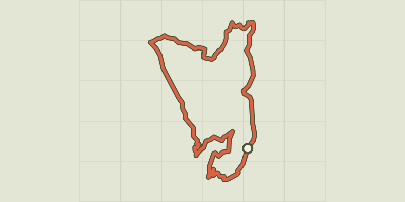 © OpenStreetMap, SRTM · OpenTopoMap (CC-BY-SA)
Le Serre du bois
Provence-Alpes-Côte d'Azur, Chorges (05) · LoopOfficial rating by Parc national des Écrins © OpenStreetMap, SRTM · OpenTopoMap (CC-BY-SA)
Les Glaisolles
Provence-Alpes-Côte d'Azur, Chorges (05) · LoopOfficial rating by Parc national des Écrins