
Le Fein loop
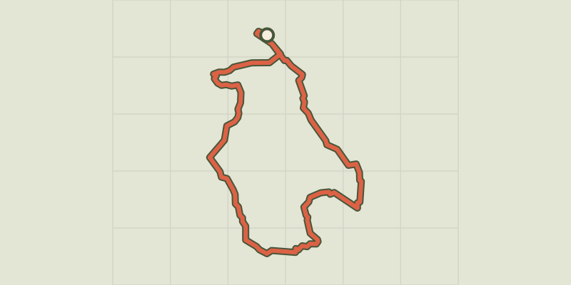
Key facts
- Distance
- 12.0 km
- Ascent
- +318 m
- Descent
- −287 m
- Estimated time
- 3 hr 15
- hiking
- Difficulty
- Easy
- official rating
- Route
- Loop
- back to the start
Profile and gradient
- under 10%
- 10 to 20%
- over 20%
Gradient along the route: 10.2 km under 10% and 1.8 km at 10 to 20%. Elevation from 828 m to 1,085 m over 12.0 km.
Description
Starting out from Chorges and passing through a series of hamlets, this loop takes you through changing landscapes, through cultivated fields and forested areas. The real richness of this trail lies in its landscapes, taking you through extensive farming plateaux and the wilder terrain of forest pathways. After setting out from Chorges you will be plunged into these differing worlds. As an added bonus, from time to time you will catch glimpses of the Lac de Serre-Ponçon. From the SNCF railway station, follow signs to « le Fein ». Continue heading towards Le Fein, and take the track on the right. At the next intersection turn right and stay on the track which rises uphill. At the next crossroads, turn left towards Les Chaussins. After a few hundred metres, turn left again towards Le Fein and continue following this direction at the next few intersections. - You come to the hamlet of Les Olliviers, on the E87. From here, continue heading towards Le Fein. When you come to the road, turn left. - After the bridge, take the track running downhill to the left and at the bottom turn right onto the path. Continue straight on until you reach the road. From Le Fein, follow signs for Chorges. When you come to the church, turn left and then right to follow the track. - After a winding section, at the next crossroads go left. - After a long descent to the next intersection, go right. When you come to the road, head towards Chorges. Take the next road on the left, then head towards « le Villard». - As you enter the hamlet, take the path on the left. Follow this until you come to an intersection, join the track and continue straight ahead. Below the bridge, turn left. Head towards Chorges until you come to the road where you started out.
Difficulty
Official rating: easy, by Parc national des Écrins.
Getting there
Start: Gare SNCF, Chorges, Chorges (05).
Sources
- Track: Parc national des Écrins, Licence Ouverte 2.0, Licence Ouverte 2.0 (Etalab) (destination.ecrins-parcnational.fr/trek/974038-Boucle-du-Fein). Time estimated by GPX Path with the Mac app rule, breaks not included.
- Official elevation gain: 318 m, Parc national des Écrins
Nearby tracks

 © OpenStreetMap, SRTM · OpenTopoMap (CC-BY-SA)
From Chorges to Baie-Saint-Michel
Provence-Alpes-Côte d'Azur, Chorges (05) · Out and backOfficial rating by Parc national des Écrins © OpenStreetMap, SRTM · OpenTopoMap (CC-BY-SA)
Le Pré de l'Aubre
Provence-Alpes-Côte d'Azur, Chorges (05) · LoopOfficial rating by Parc national des Écrins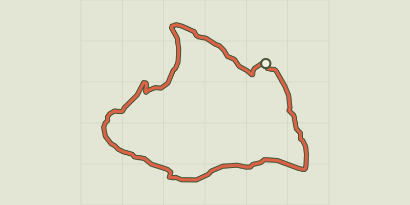 © OpenStreetMap, SRTM · OpenTopoMap (CC-BY-SA)
Bois Seignières
Provence-Alpes-Côte d'Azur, Chorges (05) · LoopOfficial rating by Parc national des Écrins © OpenStreetMap, SRTM · OpenTopoMap (CC-BY-SA)
Les Antics le Truchet
Provence-Alpes-Côte d'Azur, Chorges (05) · LoopOfficial rating by Parc national des Écrins © OpenStreetMap, SRTM · OpenTopoMap (CC-BY-SA)
Clot-Clavary
Provence-Alpes-Côte d'Azur, Chorges (05) · LoopOfficial rating by Parc national des Écrins © OpenStreetMap, SRTM · OpenTopoMap (CC-BY-SA)
La Peyre de l'aigle
Provence-Alpes-Côte d'Azur, Chorges (05) · LoopOfficial rating by Parc national des Écrins