
Le Pré de l'Aubre
Key facts
- Distance
- 5.4 km
- Ascent
- +170 m
- Descent
- −162 m
- Estimated time
- 1 hr 35
- hiking
- Difficulty
- Very easy
- official rating
- Route
- Loop
- back to the start
Profile and gradient
- under 10%
- 10 to 20%
- over 20%
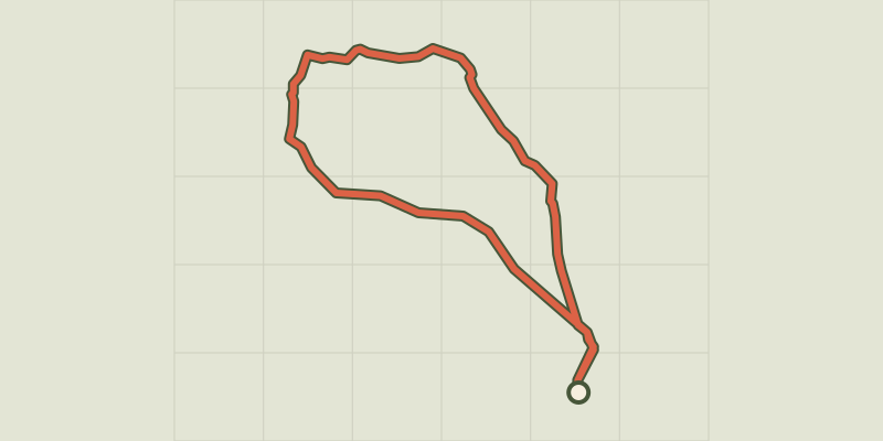
Gradient along the route: 4.1 km under 10% and 1.4 km at 10 to 20%. Elevation from 864 m to 1,025 m over 5.4 km.
Description
An easy route on the south-facing slopes that can be enjoyed in all seasons, and which quickly changes from a road skirting the fields of the village to a dilapidated path. The perfect family hike, treat yourself to a quick discovery trail around Chorges. It gives you a great view of Chorges and the peace and quiet of the surrounding area, with the added bonus of a panoramic view of the surrounding peaks. 1) From the tourist office, take rue des Eguières as far as Place du Grand Logis. Turn left and follow the Pré de l'Aubre road for around 2 km, until you reach a crossroads with 4 roads. 2) Then turn right for 250 m, (leaving the first path on your right), take the second which rises up the slope (reading table at the entrance to the path). Bit by bit, the panorama opens up over Chorges and Lac de Serre-Ponçon. 800m further on, pass to the left of a house with a porch. This is the highest point of the walk (1024m). 3) Now follow the path downhill to reach the road, which you should follow downhill for 300m. Turn right onto a track that runs alongside vineyards and meadows and heads straight back to your starting point via Rue du Pré du Château.
Difficulty
Official rating: very easy, by Parc national des Écrins.
Getting there
Start: Office de Tourisme de Chorges, Chorges (05).
Sources
- Track: Parc national des Écrins, Licence Ouverte 2.0, Licence Ouverte 2.0 (Etalab) (destination.ecrins-parcnational.fr/trek/996029-Le-Pre-de-l-Aubre). Time estimated by GPX Path with the Mac app rule, breaks not included.
- Official elevation gain: 170 m, Parc national des Écrins
Nearby tracks

 © OpenStreetMap, SRTM · OpenTopoMap (CC-BY-SA)
From Chorges to Baie-Saint-Michel
Provence-Alpes-Côte d'Azur, Chorges (05) · Out and backOfficial rating by Parc national des Écrins © OpenStreetMap, SRTM · OpenTopoMap (CC-BY-SA)
Le Fein loop
Provence-Alpes-Côte d'Azur, Chorges (05) · LoopOfficial rating by Parc national des Écrins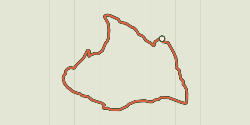 © OpenStreetMap, SRTM · OpenTopoMap (CC-BY-SA)
Bois Seignières
Provence-Alpes-Côte d'Azur, Chorges (05) · LoopOfficial rating by Parc national des Écrins © OpenStreetMap, SRTM · OpenTopoMap (CC-BY-SA)
Les Antics le Truchet
Provence-Alpes-Côte d'Azur, Chorges (05) · LoopOfficial rating by Parc national des Écrins © OpenStreetMap, SRTM · OpenTopoMap (CC-BY-SA)
La Peyre de l'aigle
Provence-Alpes-Côte d'Azur, Chorges (05) · LoopOfficial rating by Parc national des Écrins © OpenStreetMap, SRTM · OpenTopoMap (CC-BY-SA)
Clot-Clavary
Provence-Alpes-Côte d'Azur, Chorges (05) · LoopOfficial rating by Parc national des Écrins