
Les Antics le Truchet

Key facts
- Distance
- 8.1 km
- Ascent
- +500 m
- Descent
- −492 m
- Estimated time
- 3 hr
- hiking
- Difficulty
- Easy
- official rating
- Route
- Loop
- back to the start
Profile and gradient
- under 10%
- 10 to 20%
- over 20%
Gradient along the route: 3.2 km under 10%, 4.3 km at 10 to 20% and 0.6 km over 20%. Elevation from 1,127 m to 1,599 m over 8.1 km.
Description
A fairly strenuous route requiring a basic level of fitness, but offering exceptional panoramic views of the Val d'Avance, Piolit and the Aiguilles de Chabrières. After a few hundred metres of ascent and passing the hamlet of Naune Raze, you'll find yourself in the alpine zone. Look up and you may catch a glimpse of buzzards, falcons and other birds of prey. You will cross streams created by melting snow (which can dry up depending on the season). 1) From the car park, continue along the road for 200m before turning left onto a stony path. Continue straight on to the hamlet of Naune Raze. 2) Follow the main track, before turning left at Les Gontards. Follow the path, enter the Larch grove and begin a steep climb. Turn left at the first crossroads to descend towards Les Antics. 3) Once you have passed the hamlet of Les Antics, continue along the road before turning right at the crossroads. 4) Continue along this road for 900m before turning left onto a narrow path that climbs steeply. Once back on the road, turn left to find the car park.
Difficulty
Official rating: easy, by Parc national des Écrins.
Getting there
Start: Parking de Coste Belle, Chorges (05).
Sources
- Track: Parc national des Écrins, Licence Ouverte 2.0, Licence Ouverte 2.0 (Etalab) (destination.ecrins-parcnational.fr/trek/996068-Les-Antics-le-Truchet). Time estimated by GPX Path with the Mac app rule, breaks not included.
- Official elevation gain: 500 m, Parc national des Écrins
Nearby tracks

 © OpenStreetMap, SRTM · OpenTopoMap (CC-BY-SA)
Combebelle
Provence-Alpes-Côte d'Azur, Chorges (05) · LoopOfficial rating by Parc national des Écrins © OpenStreetMap, SRTM · OpenTopoMap (CC-BY-SA)
Le Piolit via the Col de Chorges
Provence-Alpes-Côte d'Azur, Chorges (05) · Out and backOfficial rating by Parc national des Écrins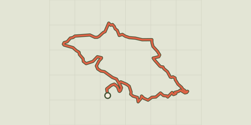 © OpenStreetMap, SRTM · OpenTopoMap (CC-BY-SA)
The slopes of Chorges
Provence-Alpes-Côte d'Azur, Chorges (05) · LoopOfficial rating by Parc national des Écrins © OpenStreetMap, SRTM · OpenTopoMap (CC-BY-SA)
Col de la Gardette
Provence-Alpes-Côte d'Azur, Chorges (05) · Out and backOfficial rating by Parc national des Écrins © OpenStreetMap, SRTM · OpenTopoMap (CC-BY-SA)
Le Fein loop
Provence-Alpes-Côte d'Azur, Chorges (05) · LoopOfficial rating by Parc national des Écrins © OpenStreetMap, SRTM · OpenTopoMap (CC-BY-SA)
From Chorges to Baie-Saint-Michel
Provence-Alpes-Côte d'Azur, Chorges (05) · Out and backOfficial rating by Parc national des Écrins