
Cascade de la Pisse in Châteauroux-Les-Alpes
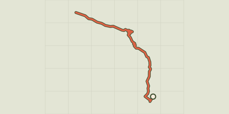
Key facts
- Distance
- 10.5 km
- Ascent
- +311 m
- Descent
- −266 m
- Estimated time
- 2 hr 55
- hiking
- Difficulty
- Easy
- official rating
- Route
- Out and back
- same way back
Profile and gradient
- under 10%
- 10 to 20%
- over 20%
Gradient along the route: 8.9 km under 10% and 1.6 km at 10 to 20%. Elevation from 1,296 m to 1,452 m over 10.5 km.
Description
Edged by the canal, close to the famous Rabioux mountain stream and the approaches to the Parc National des Écrins, this loop offers both tranquillity and freshness. Watery environments past and present as the central theme of a pleasant forest walk. Explore the forest, catching glimpses of the turbulent Le Rabioux mountain stream. From the shade of the trees, admire the three valleys on the opposite slope. Crossing the Les Muandes footbridge, make your way to the 40-metre high waterfall, the Cascade de la Pisse. On the return path, at the foot of the combes pasturelands come into view. The way passes across a number of streams before reaching the first slope again. From the car park, head along the track towards the waterfall (Cascade de la Pisse). Then turn right onto the path. Follow the Canal Gramorel. - At the next intersection, go slightly downhill to the right and take the narrow path opposite, towards the Cascade de la Pisse. At the next intersection, go straight ahead. When you reach the « Torrent du Rabioux » continue to head towards the Cascade de la Pisse. Cross the Les Muandes footbridge and rejoin the track. Then go left to the Les Muandes car park. Head down the path on the right to reach the waterfall. At the waterfall, return along the same track back to the intersection at the footbridge. - Here, turn left onto the forest track. A few metres further up, turn right at « Le vieux Chemin » towards Les Pinées via Pont de la Serre. Carry straight on towards Les Pinées. You go past chalets and streams. - At the next « La Serre » intersection turn right downhill towards Les Pinées. On the road, you pass the Jean Blanc spring and the bridge. After the bend, turn right onto the path leading uphill towards Les Pinées. Then rejoin the outward path: turn left towards Les Pinées
Difficulty
Official rating: easy, by Parc national des Écrins.
Before you go
- The Cascade de la Pisse can be reached by staying on the track after the Le Rabioux footbridge.
Getting there
Start: Les Pinées, Châteauroux-les-alpes, Châteauroux-les-Alpes (05).
Sources
- Track: Parc national des Écrins, Licence Ouverte 2.0, Licence Ouverte 2.0 (Etalab) (destination.ecrins-parcnational.fr/trek/974077-La-cascade-de-la-Pisse-a-Chateauroux-les-Alpes). Time estimated by GPX Path with the Mac app rule, breaks not included.
- Official elevation gain: 311 m, Parc national des Écrins
Nearby tracks

 © OpenStreetMap, SRTM · OpenTopoMap (CC-BY-SA)
The Roche Rousse belvedere
Écrins, Châteauroux-les-Alpes (05) · Out and backOfficial rating by Parc national des Écrins © OpenStreetMap, SRTM · OpenTopoMap (CC-BY-SA)
Sentier des Vignes - Grapevine path
Écrins, Châteauroux-les-Alpes (05) · LoopOfficial rating by Parc national des Écrins © OpenStreetMap, SRTM · OpenTopoMap (CC-BY-SA)
Chemin de la Durance
Écrins, Châteauroux-les-Alpes (05) · Out and backOfficial rating by Parc national des Écrins © OpenStreetMap, SRTM · OpenTopoMap (CC-BY-SA)
Lake Distroit
Écrins, Châteauroux-les-Alpes (05) · Out and backOfficial rating by Parc national des Écrins © OpenStreetMap, SRTM · OpenTopoMap (CC-BY-SA)
Saint-Alban loop
Écrins, Châteauroux-les-Alpes (05) · LoopOfficial rating by Parc national des Écrins © OpenStreetMap, SRTM · OpenTopoMap (CC-BY-SA)
Cabane de l'Aiguille loop
Écrins, Embrun (05) · LoopOfficial rating by Parc national des Écrins