
Lac du Siguret
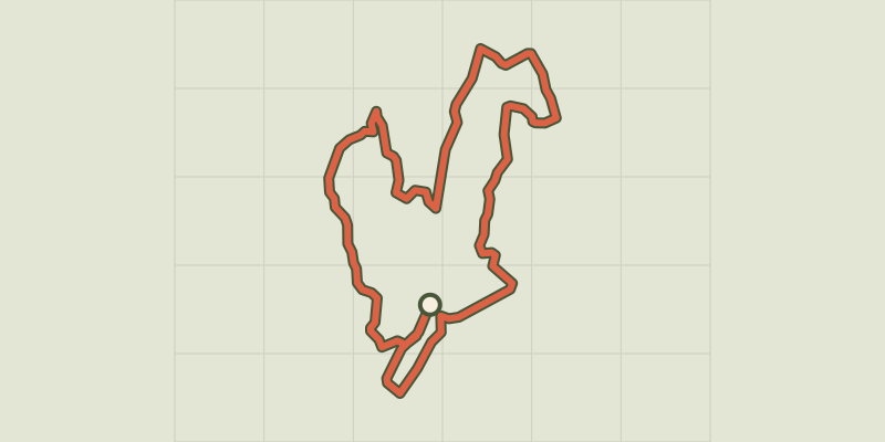
Key facts
- Distance
- 5.1 km
- Ascent
- +136 m
- Descent
- −113 m
- Estimated time
- 1 hr 25
- hiking
- Difficulty
- Very easy
- official rating
- Route
- Loop
- back to the start
Profile and gradient
- under 10%
- 10 to 20%
- over 20%
Gradient along the route: 4.9 km under 10% and 0.3 km at 10 to 20%. Elevation from 1,015 m to 1,119 m over 5.1 km.
Description
Fenced in by mountains, this circuit takes you through a bucolic environment to the lake and the chapel. Let the wind carry you around this loop, which runs primarily through farmland and has numerous stone ruins along the way. Hug the edges of fields and forest and then emerge into a sunny embrace. Relax on the shores of the Lac du Siguret before visiting the small chapel of St-Roch. From the car park, go left onto the track leading to the « chemin du Lauzerot » sign. - Then take the uphill track on the right following the "Chemin du Lauzerot". Keep left on the narrow track which runs along the edge of the fields and continues uphill along the forest edge. At the next intersection, near the field, take the track on the left. - After a few hundred metres, turn right and continue down the hairpin bend. - When you come to a ruined house, turn left at the intersection. - Follow the path and when you reach the intersection among the fields, turn right. Follow the track until you come to another intersection. Then turn left. Stay on this track and go past the bend. After the bend, turn right onto the path running downhill to the lake. Pass the area of small boulders and the stream and continue straight ahead after the bench. - Take the next track on the left which leads to the chapel of St-Roch. Go past the chapel and continue straight ahead on the track which leads down to the road. Turn right onto the road which brings you back to the car park.
Difficulty
Official rating: very easy, by Parc national des Écrins.
Before you go
- Bathing is permitted, but is not supervised.  Fishing is also permitted on the Lac du Siguret.
Getting there
Start: Lac de Siguret, Saint-André-d'Embrun (05).
Sources
- Track: Parc national des Écrins, Licence Ouverte 2.0, Licence Ouverte 2.0 (Etalab) (destination.ecrins-parcnational.fr/trek/974208-Lac-de-Siguret). Time estimated by GPX Path with the Mac app rule, breaks not included.
- Official elevation gain: 136 m, Parc national des Écrins
Nearby tracks

 © OpenStreetMap, SRTM · OpenTopoMap (CC-BY-SA)
Sentier des Vignes - Grapevine path
Écrins, Châteauroux-les-Alpes (05) · LoopOfficial rating by Parc national des Écrins © OpenStreetMap, SRTM · OpenTopoMap (CC-BY-SA)
Chemin de la Durance
Écrins, Châteauroux-les-Alpes (05) · Out and backOfficial rating by Parc national des Écrins © OpenStreetMap, SRTM · OpenTopoMap (CC-BY-SA)
Saint-Alban loop
Écrins, Châteauroux-les-Alpes (05) · LoopOfficial rating by Parc national des Écrins © OpenStreetMap, SRTM · OpenTopoMap (CC-BY-SA)
The Roche Rousse belvedere
Écrins, Châteauroux-les-Alpes (05) · Out and backOfficial rating by Parc national des Écrins © OpenStreetMap, SRTM · OpenTopoMap (CC-BY-SA)
Cascade de la Pisse in Châteauroux-Les-Alpes
Écrins, Châteauroux-les-Alpes (05) · Out and backOfficial rating by Parc national des Écrins © OpenStreetMap, SRTM · OpenTopoMap (CC-BY-SA)
Belvédère de l'Homme de Pierre - Risoul
Provence-Alpes-Côte d'Azur, Risoul (05) · LoopOfficial rating by Parcs naturels régionaux de Provence-Alpes-Côte d'Azur